

This post continues our list of North America’s most scenic highways. Here, you’ll find Scenic Highways 6 through 10. Let’s start this post in Canada with what many people think is the world’s most beautiful drive. I would agree.
6. Icefields Parkway, Alberta, Canada
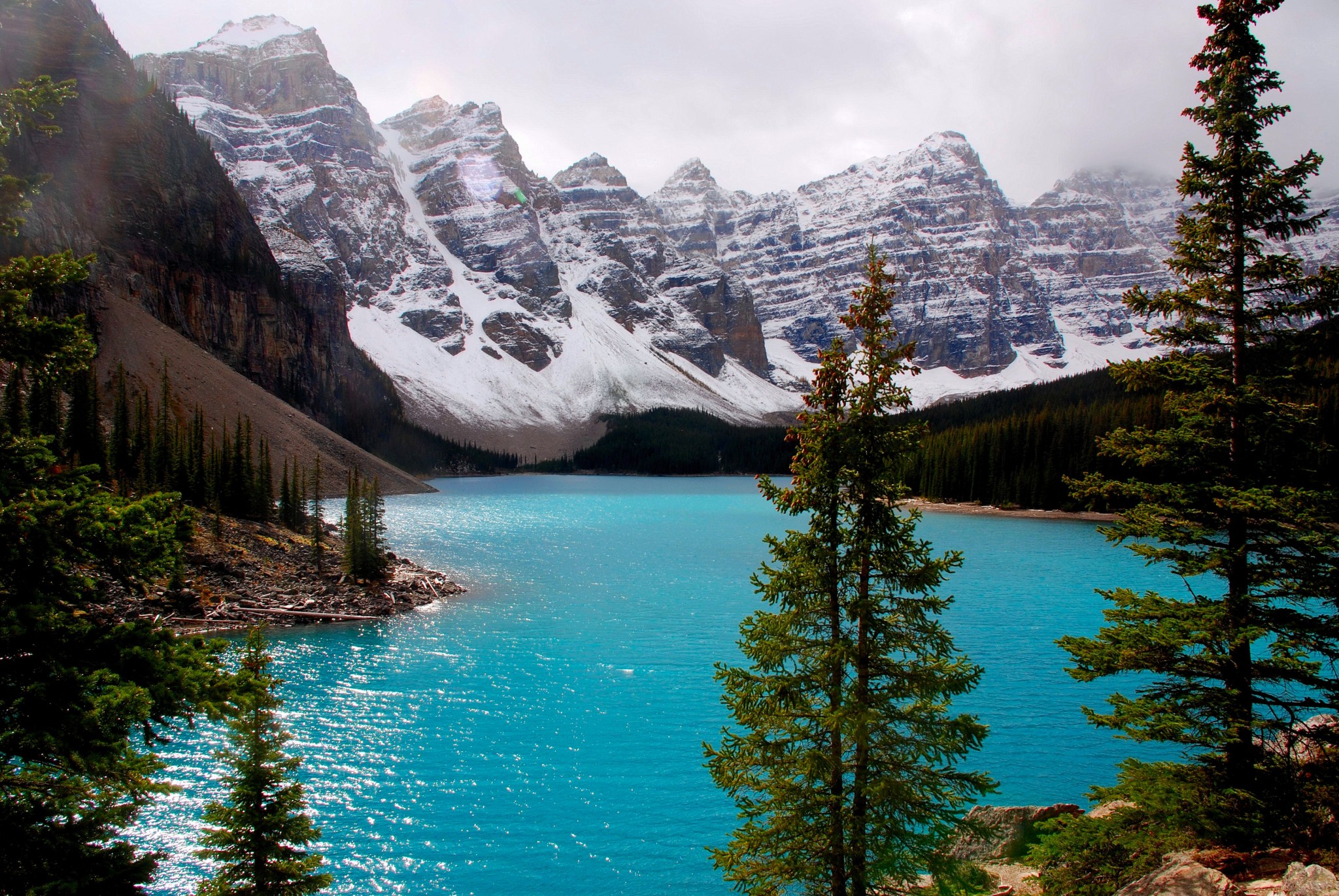
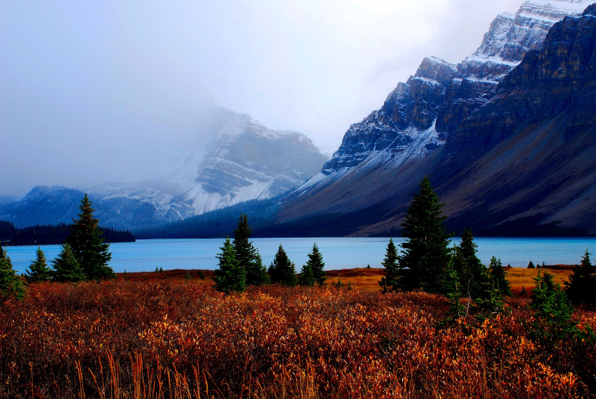
Here are the Canadian Rockies in all their splendor. The Icefields Parkway runs through the heart of these spectacular mountains – 142 miles of nonstop WOW! Every bend of the road reveals a breathtaking panorama. You’ll see jagged peaks, knife-edged ridges, meadows, dense forests, massive icefields, rushing rivers, waterfalls, and lakes colored turquoise by glacial meltwater. If you’ve never been there, you’ve seen this country on postcards, calendars, magazine ads and even on Canadian currency. The lead photo above is Moraine Lake near Lake Louise.
The parkway runs from Lake Louise north to Jasper, connecting Banff and Jasper National Parks. Driving time is about 3 ½ hours, but you should allow a full day. Better yet, spend the night at the end of the road, then turn around and drive it again in the other direction. The road is nicely engineered and a pleasure to drive. It’s ideal for cars, SUVs, motorcycles and RVs. It’s also one of the very best roads for bicycle touring. There are plenty of turnouts, and the shoulders are wide enough to keep cyclists safe. You’ll find plenty of hiking trails ranging from easy walks to challenging treks. A store and gas station are at Saskatchewan River Crossing, which is about one-third of the way from Lake Louise to Jasper. The nearest major airport is in Calgary. You can also reach Banff in a day from Seattle or Vancouver. An entrance fee is charged at either end.
These are Canada’s most popular national parks. Visitors come here from all over the world. As a result, the parks can get crowded in summer. Also, proximity to Calgary means visitation jumps on the weekend, especially around Banff and Lake Louise. I’ve had the best luck here by visiting in September and October, when the weather is generally good, the foliage is turning, and the crowds are mostly gone. Of course, during my last visit in mid-October 2012, it snowed the entire time. Jasper draws about one-third fewer people than Banff. The road is plowed in winter, and there are ski areas at either end of the highway.
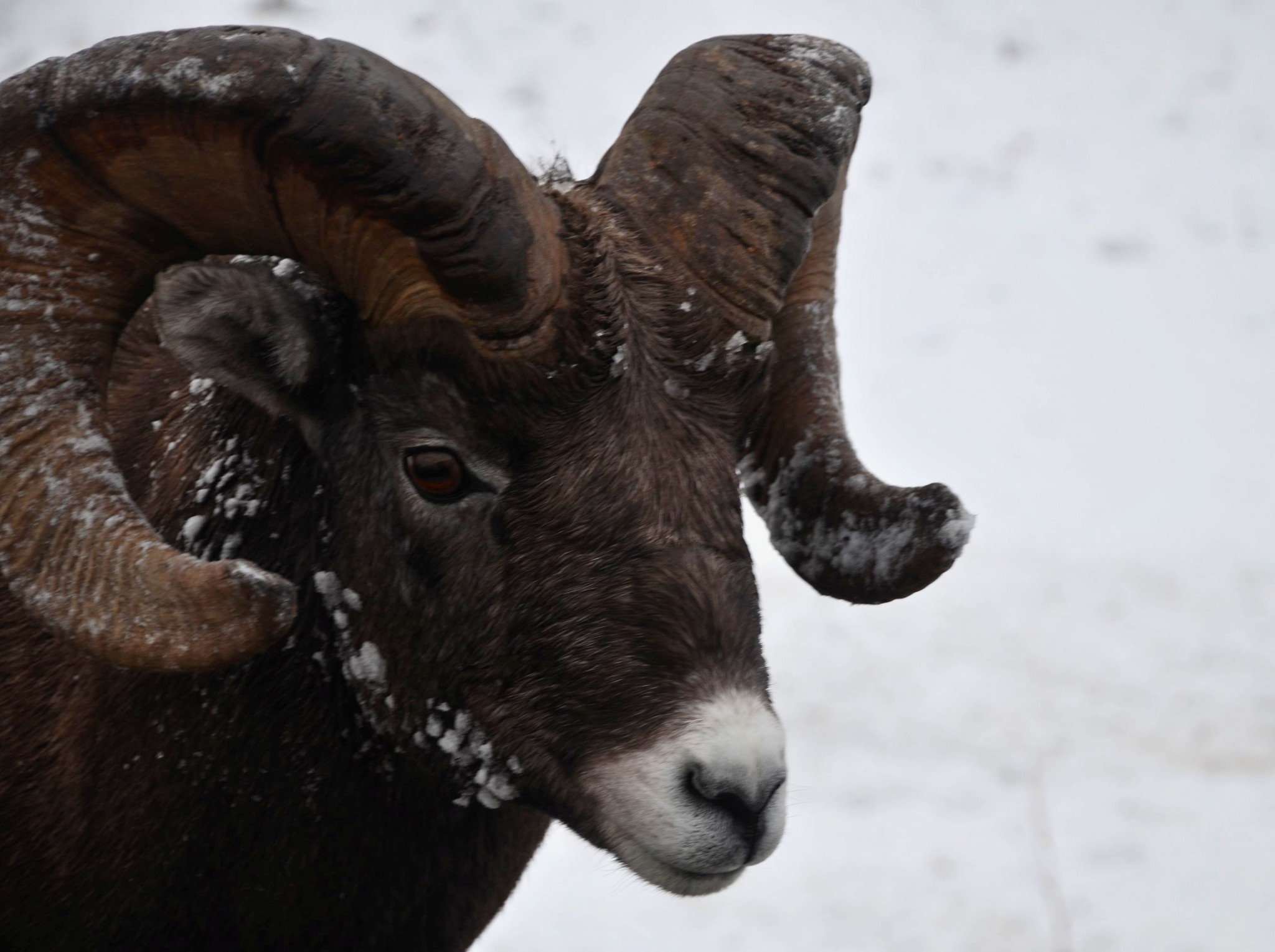
My favorite spot is gorgeous Bow Lake, with Crowfoot Glacier at its edge. Just north of there, you can take a short trail to a viewpoint overlooking Peyto Lake — a glacial lake of the deepest turquoise color you can imagine. The Columbia Icefield is where you can take a bus with special tires right out onto a glacier; these trips are extremely popular despite being overpriced. Wildlife along the Icefields Parkway is plentiful and easy to spot, especially mountain goats, black bears and bighorn sheep. Grizzlies, moose and elk live here, too, but they’ve managed to avoid me so far.
There are accommodations in Banff, Lake Louise and Jasper, but they’re expensive. However, if any road trip is worth a splurge, this is it. If you put this trip at the top of your road trip bucket list, you’ll thank me.
7. Cherohala Skyway, Tennessee and North Carolina
Great Smoky Mountains National Park is, by far, America’s most popular park, with a whopping 10 million annual visitors. I’m talking traffic jams and no place to park at trailheads and other attractions – even outside the summer season. I’ve seen the scenic side road to Cades Cove totally gridlocked on a weekend in May.
Frankly, I don’t think the park’s scenic value justifies the crowds you have to deal with when you visit. Which brings us to the Cherohala Skyway. Here you’ll find a very similar road trip experience with a very small fraction of the traffic.
The Cherohala Skyway runs from Tellico Plains in southeastern Tennessee to Robbinsville in southwestern North Carolina. Route designations are Tennessee SR 165 and North Carolina 143. The drive is fine for all types of vehicles. Elevations vary from 900 feet to 5,400 feet at the state line. It’s a great fall foliage and spring wildflower drive. Near the western end, you’ll want to take the side road leading to Bald River Falls. Despite the relative anonymity of this scenic drive, you’re best off taking it on a weekday. It’s close enough to metro Atlanta to attract day trippers.
From Robbinsville, you can take US 74 along the Nantahala River, which is heavily used by whitewater raft trips in spring and early summer. Just beyond that is Franklin, where you can pick up the Cullasaja Gorge scenic route.
8. US 101, Trinidad to Crescent City, California
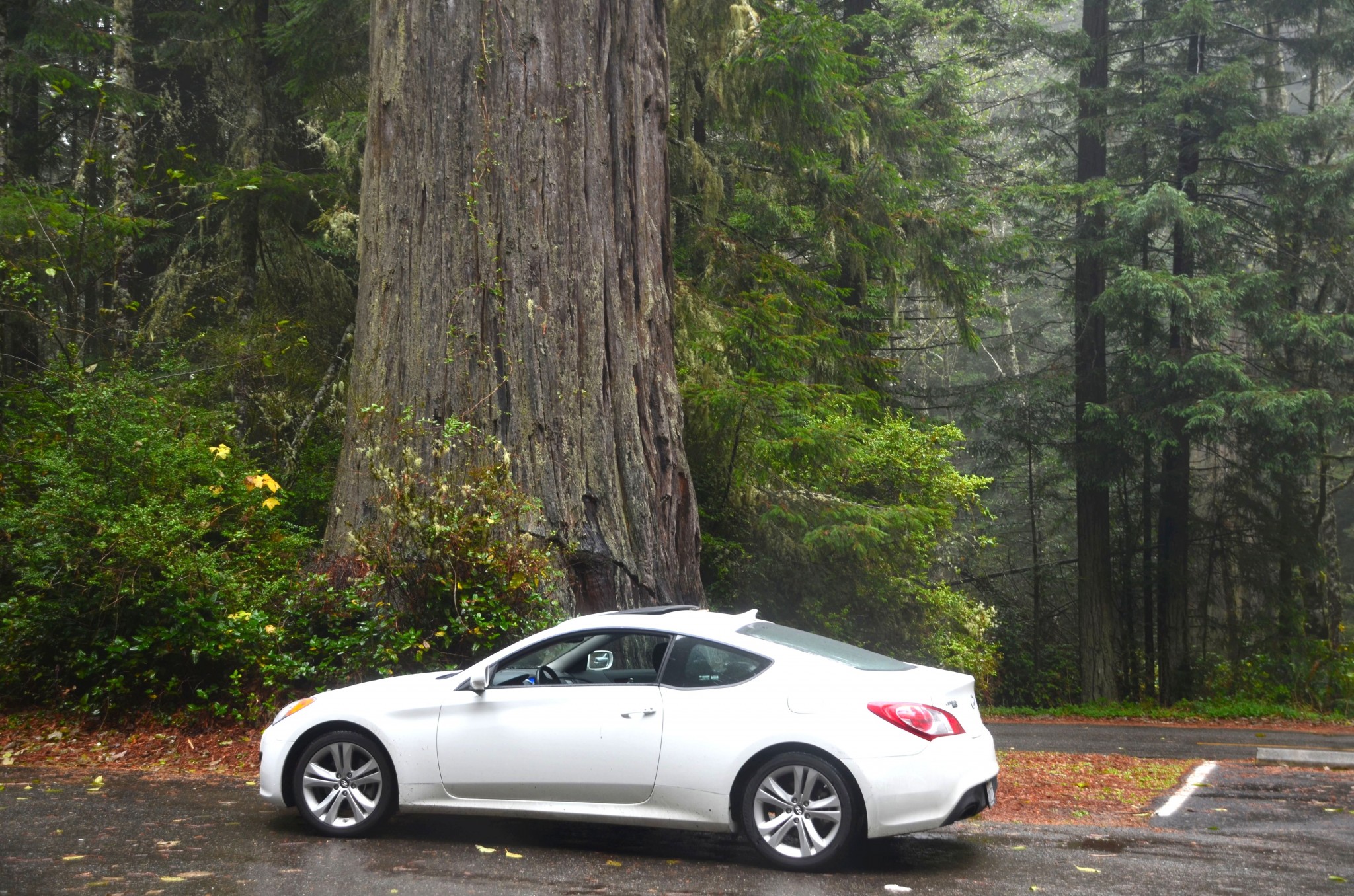
Our next two scenic highways are so close to each other that it makes sense to combine them on the same road trip. The first one is about redwoods. The far northwestern corner of California is the climax region for the coast redwood – the world’s tallest tree. Here, three state parks and one national park exist in a somewhat confusing juxtaposition. US 101 is a fast road that carries a lot of commercial traffic. Because of that, a lot of people blow through the park, then head somewhere else. Don’t. This area reveals itself in pieces. So although the road can be driven in just over an hour, you should allow a day to enjoy the road trip.
It rains a lot in this country. While summer offers the driest weather here, it also brings heavy fog and relatively big crowds. Spring and fall can be nice. Winters are rainy, but rain doesn’t detract from the rainforest ambience of the region. The park is too far from major cities for weekenders, so while seasonality affects visitation, the day of the week doesn’t matter.
Accommodations are plentiful along the way, as are campgrounds. Please keep in mind that state park campgrounds need to be reserved during much of the year. Check the park’s website (www.nps.gov/redw/index) for details. Flying? San Francisco is probably your best choice, although United has a few expensive flights into Arcata, California.
Start in Trinidad, about 30 minutes north of Eureka on US 101. Take a short detour off the freeway to see the funky little lighthouse and offshore rocks. Next stop is the Thomas Kuchel Visitor Center near Orick. Ask the rangers where the local Roosevelt elk population is hanging out; you won’t want to miss seeing them. If you’re coming from the north, stop at Redwood National Park headquarters in Crescent City for the same information.

Just past Orick is the turnoff to Lady Bird Johnson Grove – an especially great grouping of huge trees. Another good side trip is unpaved Davison Road, which leads west to Gold Bluff Beach and lush Fern Canyon (no trailers). Elk often hang out in the big meadow next to the turnoff. Next, take the Newton Drury Parkway for a leisurely drive through the redwood forest. This is the original route of US 101; it was designated a scenic drive when 101 was re-routed a few years ago. My favorite redwood drive is Howland Hill Road, which can be accessed from the southern end of Crescent City and winds through Jedediah Smith Redwood State Park. As you enter Crescent City, turn east on Elk Valley Road, then turn right again on Howland Hill Road. The road is narrow and unpaved – not suitable for RVs. If you’re a Star Wars fan, you’ll recognize this as the “Forest Moon of Endor.” Bring your speeder.
If you’re continuing north from here, you might want to stay in Brookings, Oregon, which is a much nicer town than Crescent City.
US 101, Brookings to Bandon, Oregon
All of Oregon’s coast is scenic. However, the most rugged portion is also the farthest from major cities. Even in summer, it rarely gets too crowded on this 83-mile stretch. From Brookings, just north of the California border, US 101 hugs the coast to Gold Beach, then plays tag with it the rest of the way to Bandon. The highway is wide and smooth, with lots of turnouts and parking lots for beachcombing, sightseeing and photography. This is as nice a coastal drive as you’ll find anywhere. It’s ideal for all types of vehicles, including bicycles. If you’re flying, land in either Portland or San Francisco, but expect a long drive from there to the southern Oregon coast.
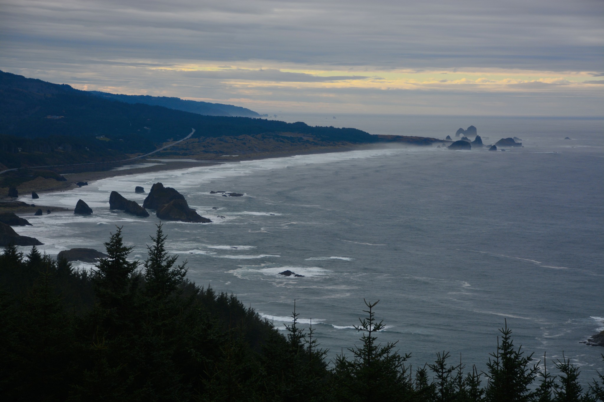
Driving north on US 101, you pass a succession of rocky headlands, coves and sandy beaches – all public and mostly free to visit. There are towns along the way, but they’re small with limited facilities. First stop is on the north edge of Brookings – Harris Beach State Park, one of my favorite beach parks. Here you’ll find numerous sea stacks just offshore and tidepools to explore. It’s a great spot for photographing the sunset. The park is open for both day use and camping. Next is Cape Sebastian. Take the side road to the overlook for a tremendous view. Samuel Boardman State Park extends about 10 miles and has several access points. At Gold Beach, the Rogue River flows into the Pacific. From here you can take one of the famous jet boat rides up the Rogue.
Port Orford is the westernmost town in the lower 48. Check out the unique harbor, where fishing boats are launched with help from a crane. Finally, at Bandon, the town perches on a bluff overlooking a beach littered with dramatic sea stacks. Bandon has a funky old town section and plenty of visitor services. You’ll also find ample accommodations in Brookings and Gold Beach.
Utah SR 128, Moab to I-70
From four routes with lots of lush forest, we’ll move to a wilderness of stone. Southeastern Utah is red rock country, with a slew of scenic driving routes. Here’s one you’ll love. SR 128 runs along the Colorado River at water level, just across the river from Arches National Park. This is the only water-level route along the Colorado between Moab and Laughlin, Nevada. Distance is 43 miles; allow 1 ½ hours. Nearest major airport is Salt Lake City; a few flights land in Grand Junction, Colo. The highway is suitable for all types of vehicles, including bicycles. There are no services along the route. Carry water if you plan to do any hiking.
After leaving US 191 where it crosses the Colorado, SR 128 follows the river between towering walls of red sandstone. In places where the scenery opens up, you can see dramatic buttes in the distance. Depending on the season, you may also see commercial whitewater raft groups here. There’s one major junction along the way, where a road branches off and leads to Castle Valley and the La Sal Mountains. It’s worth a detour. A few miles along this road, you’ll pass Castle Rock, where General Motors once placed a truck via helicopter for an ad. As the side road climbs into the La Sals, there’s a tremendous view westward of awesome canyon country.
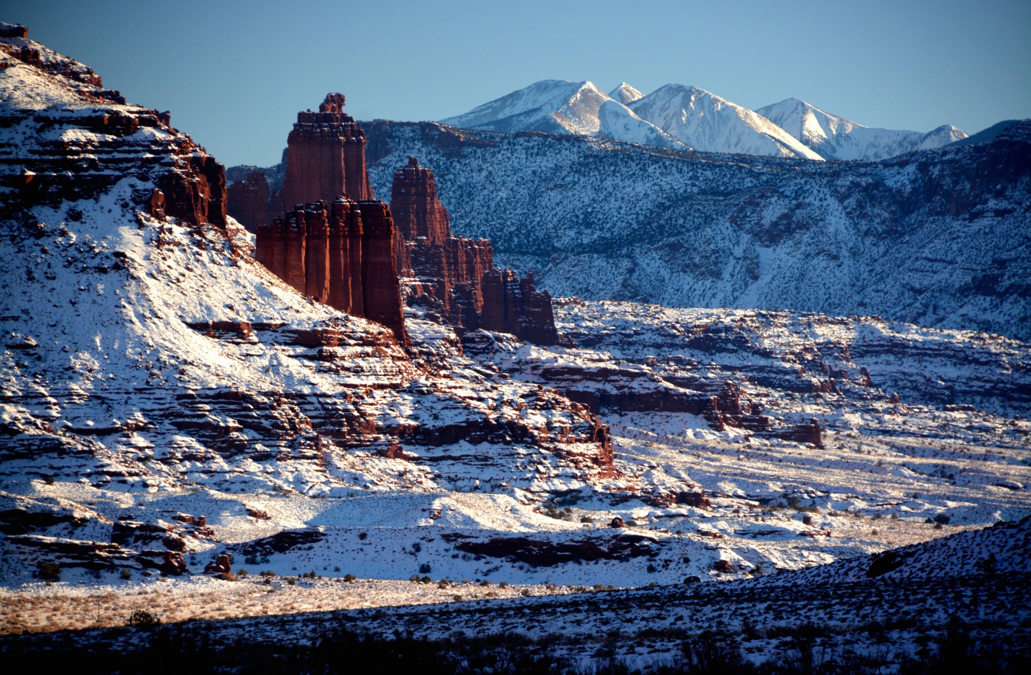
Back on the main scenic highway, you’ll soon pass the Fisher Towers – gigantic columns rising more than 900 feet. A dirt road leads to the base, where you’ll find hiking trails. About 40 miles out, SR 128 crosses the river, then heads north to I-70. From the junction, you can head east on 70 into Colorado, or return to Moab via I-70 westbound and US 191.
Recommendation: If you plan to take photos, drive this road in mid- to late afternoon for the best lighting. Fisher Towers take on a deep red glow during the last hour of sunlight. The best view is looking back at the towers from 2-3 miles beyond with the La Sals in the background.