

This week we’ll show you more geologic and scenic eye candy as we visit Capitol Reef National Park in south-central Utah.
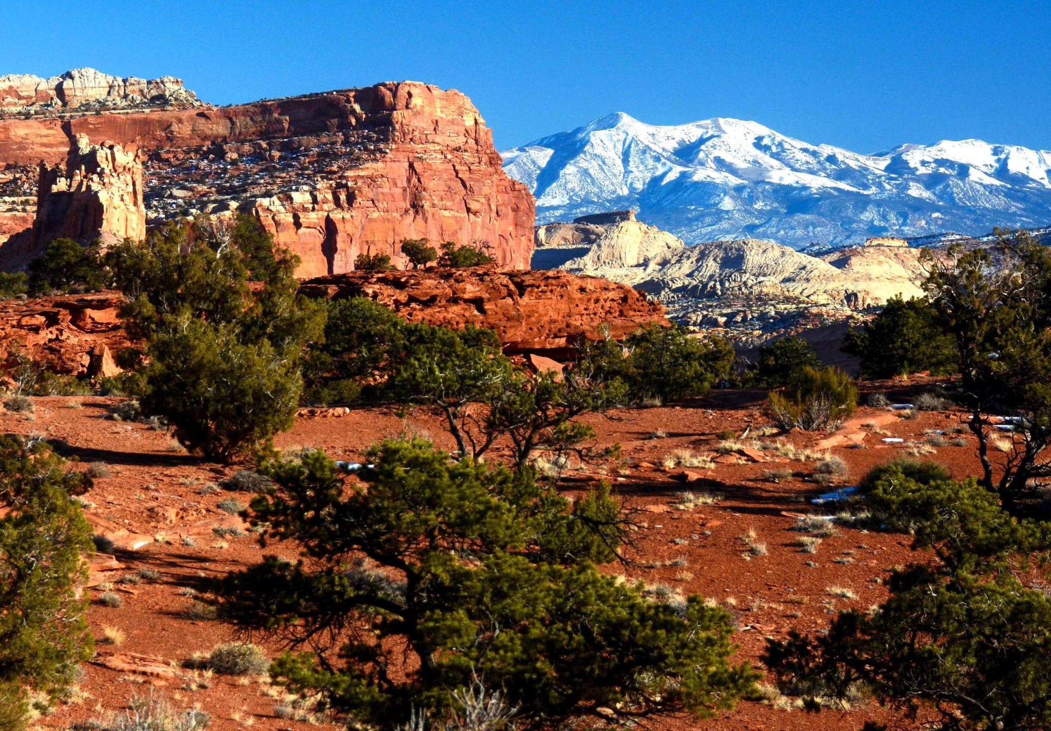
Featured photo: Panorama Point on a late December afternoon. PHOTO: Tom Dell
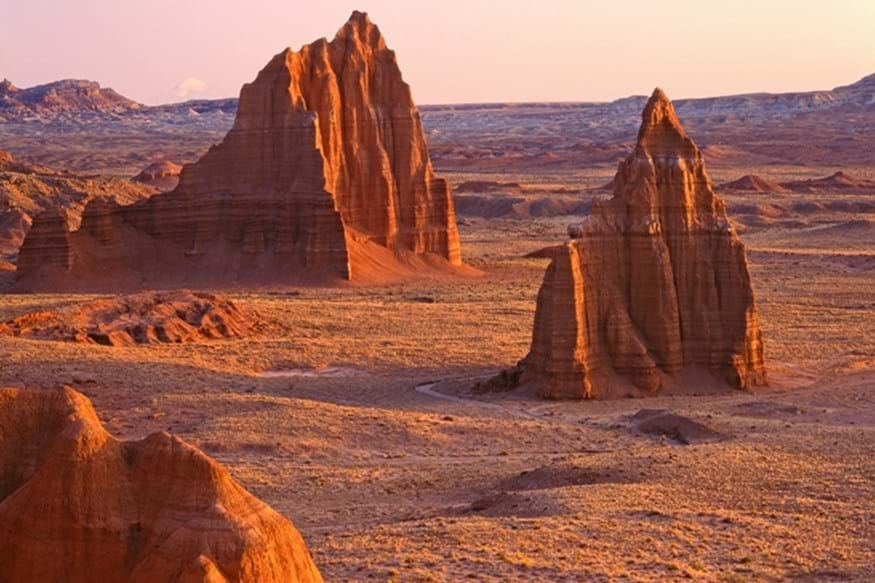
Native people called this “land of the sleeping rainbow.” In Capitol Reef’s sandstone formations, you’ll find a dazzling palette of colors and textures. Millions of years ago, geologic forces squeezed seven distinct layers of stone together creating a wrinkle in the earth’s crust. This 100-mile-long wrinkle is known as the Waterpocket Fold, which is clearly visible in the aerial photo below. Erosion then sculpted the wrinkle, resulting in the cliffs, canyons, domes, arches and natural bridges you see today.

Scenery, history and free food at Capitol Reef
Capitol Reef is one of my three favorite national parks – the others being Arches and Glacier. I love the power of its landscapes, its aura of timelessness and expansiveness, the fact it was one of the last places in the West to be discovered by non-natives, and the sense it’s uncrowded even though just over a million people visit the park each year.
To me, it seems uncrowded for three reasons. First, it’s remote. Second, I’ve only visited in off-season; summer can be crowded. And third, it’s often used as a pass-through by people rushing from Bryce Canyon to Arches. People who rush through the park will miss much of what makes it a special place.

Don’t ignore Capitol Reef when planning a trip to Utah’s national parks. In addition to one of the best geology lessons you can get, the park offers great hiking, bicycling, camping, four-wheeling, rock climbing and canyoneering, along with ancient petroglyphs, pioneer history and – maybe, depending on when you’re there – free food!
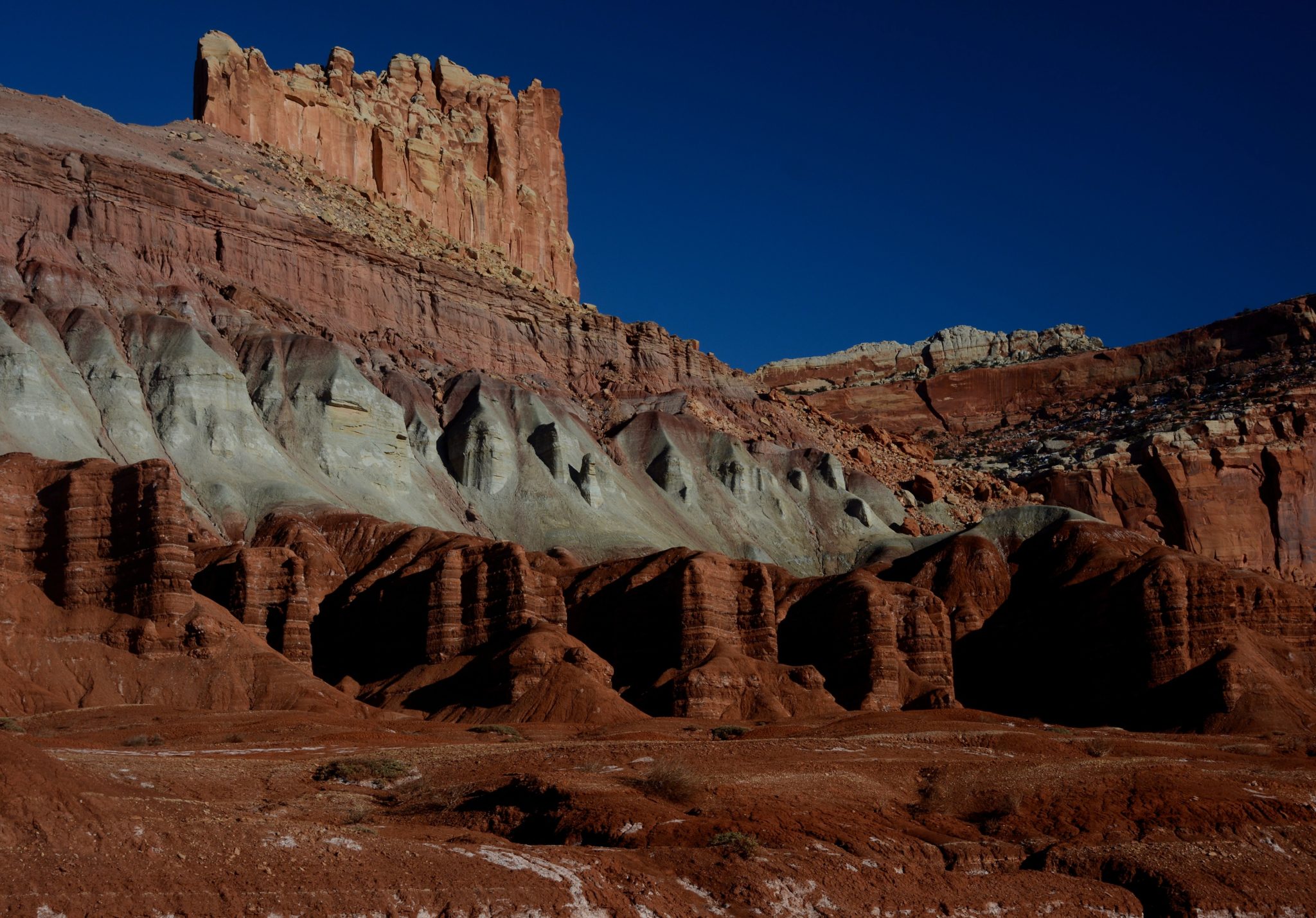
Most visitors arrive on SR 24 from the west. Many come from Bryce Canyon via Scenic SR 12, which is such an awesome drive that I’ll do a separate post on it later this year. Highways 12 and 24 meet in the village of Torrey, where you’ll find a good choice of accommodations. The park entrance is about 10 miles east of Torrey. Along the way, SR 24 runs alongside towering cliffs that show off the park’s layer-cake geology — see photo at left.
Mormon polygamists
Just inside the park entrance is the turnoff to Panorama Point, where the featured photo at the top of this post was taken. In the background are the 11,000-foot high Henry Mountains, last major range in the Lower 48 to be discovered. A good dirt road leads another mile to the goosenecks of Sulphur Creek.
Another couple of miles brings you to the turnoff for the park’s visitor center, the old Mormon farming community of Fruita, the park’s very nice campground, and the 10-mile paved scenic drive.
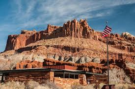
Start at the visitor center, which is open 8-4:30 daily. Displays explain the area’s geology. Check the schedule of ranger-led walks and other programs. The park’s entrance fee is $15 for both cars and motorcycles. Camping costs $20 per night.
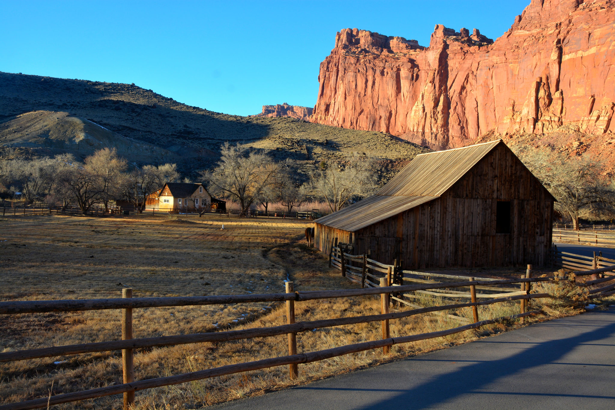
Just beyond the visitor center are the orchards and restored buildings of Fruita, where Mormon pioneers established fruit orchards and planted hay, alfalfa, sorghum and vegetables. The population never exceeded 10 families. (Of course, some of these people were polygamists, who had very big families.) The contrast between the greenery here along the Fremont River and the surrounding desert is a stark one.
Nonstop WOW!
From June to October you’re welcome to pick ripe fruit in the orchards, which have 3,000 trees. If you eat it there, it’s free. If you take it with you, you’ll pay a small charge. Cherries ripen in June, apricots in July, pears in August and apples in September/October.
The largest structure, the Gifford House, has been restored and now serves as a combination store and museum of pioneer life. It’s open 8-4:30, March 24-October 29.
Continuing south on the scenic drive, you have a nonstop parade of WOW. The turnoff to Grand Wash takes you into a canyon, where you can stroll beneath 800-foot-high cliffs. The pavement ends at the entrance of Capitol Gorge; you can continue on a good dirt road another two miles, then on foot to view Indian petroglyphs and reach other trailheads.

Web site has useful links
The park’s very useful web site can be found at www.nps.gov/care. Links take you from the landing page to information on the park’s history, geology, campgrounds, orchards and 15 hiking trails. For road guides to the scenic drive and two backcountry routes, go to the web site landing page, then follow this path: Plan your visit >> Things To Do >> Outdoor Activities >> Road Tours. As I mentioned earlier, you’ll find accommodations in nearby Torrey. (When I visited in late December a few years ago, only the Best Western and one restaurant were open, but both were satisfactory; more accommodations have opened in recent years.) Speaking of seasons, the park only gets about 7 inches of precipitation annually. Blue skies are the norm, even in winter. Summers are hot. Most of Capitol Reef’s rain comes as summer thundershowers. For me, fall and winter are the best times. The elevation at Fruita is about 6,000 feet.
As mentioned earlier, if you’re driving to Capitol Reef from Bryce Canyon, you can come via the dramatic route known as Scenic SR 12. The distance from Bryce to Torrey is about 110 miles, but you should allow at least three hours. This is one of the continent’s great scenic drives – some people say it’s the most scenic. At one point, the road winds along a slickrock ridge with thousand-foot dropoffs on both sides. Be sure to take the side road to Kodachrome Basin State Park, and visit the restored Indian pueblo in the hamlet of Boulder. Gas, food and lodging can be found in Escalante and Boulder. Much of the drive is within the Grand Staircase-Escalante National Monument.
Two routes to Arches
If you’re driving from Capitol Reef to Arches and/or Canyonlands National Parks, you can get there in half a day, or you can take the much more scenic and interesting route and spend a full day. I, of course, recommend the latter.
Leaving Fruita, you have two stops within the park. Just under a mile from the visitor center is the Fruita schoolhouse. You can’t enter it, but you can peek in the windows to view the restored interior and furnishings. Just past the schoolhouse is a turnout and boardwalk for viewing a group of petroglyphs etched into the cliff along the Fremont River. In front of you is the white Navajo sandstone formation known as “Capitol Dome,” which gave its name to the park.
You can eat and get gas at Hanksville
The landscape opens up east of the park boundary and passes through some interesting badlands until, after 49 miles, you arrive in the village of Hanksville, which is known for its remoteness (you’re in the middle of nowhere here!) and the gas station/convenience store that’s literally burrowed into a cliff. Be sure to fill Old Betsy’s tank in Hanksville. The town also has a couple of small motels and cafes.
Stay on SR 24 if you want the quick route to Moab, where you’ll stay overnight if you visit Arches and/or Canyonlands. Turn east on I-70, then south on US 191. For the scenic route, turn right at Hanksville onto SR 95, then continue via a dramatic crossing of Lake Powell and Natural Bridges National Monument to Blanding. From there, go north on US 191 to Moab. It’s nonstop scenery the entire way.
That’s it for now. Thanks for reading! We’ll be taking a break from Utah’s national parks for a couple of weeks. Next, on January 22, we’ll head to Steamtown National Historic Site in Scranton, Pennsylvania.