
Welcome to the second of two posts focusing on Death Valley National Park. In last week’s post, we began by considering why this “desert’s desert” is worth visiting and belongs on every road-tripper’s bucket list. We then offered details on how to get there, when to come and where to stay. If you haven’t yet read last week’s post, I urge you to do so before you read this one. Simply go back to the landing page, then scroll down to find Part One.
This week, let’s work on your sightseeing agenda in Death Valley. There’s no single iconic attraction that symbolizes the park, like an Old Faithful, Half Dome or Crater Lake. Instead, you’ll find several points of interest that merit your time and attention. Most involve short to moderate walks.
Good news: You have to do a lot of driving to get to the park. Once there, however, distances are generally reasonable, and the roads are good. With one exception, the destinations described in this week’s post are all easily reached in Old Betsy. Of course, for the adventuresome among you who want to really, really get away, Death Valley National Park offers plenty of backcountry requiring highly capable vehicles and drivers who know what they’re doing. If that’s what you’re looking for, you’ll want to go to www.nps.gov/deva/planyourvisit/backcountryroads and consult with park rangers before setting out.
The list I’ve prepared for your consideration is divided into four geographic areas: Furnace Creek area, Badwater Road, Stovepipe Wells area, and everything else.
All photos are by Tom Dell, except where indicated. Click on the smaller photos to enlarge.
Furnace Creek area
Furnace Creek is the focus of visitor activity in the park. Think of it as downtown Death Valley. As you approach, groves of tall palms and tamarisk trees mark it as an oasis, which it is. The Timbasha Shoshone have lived here for centuries. More recently, Furnace Creek was the headquarters of the U.S. Borax Co.
Here, you’ll find the park’s two largest lodging facilities, three campgrounds, restaurants, shops, full service gas station (with AAA towing), and a small borax museum. There’s even a golf course and an airstrip.
Furnace Creek Visitor Center
It’s also the location of the park’s visitor center, which has the usual Park Service setup and amenities: Exhibits, displays, a 20-minute video, a bookstore, clean restrooms, fresh water and helpful rangers. This is the ideal place to begin your Death Valley visit. Be sure to check the schedule of ranger-led visitor programs.
Harmony Borax Works
A turnoff 2 miles north of Furnace Creek leads to this remnant of Death Valley’s mining history. You’ll see the ruins of the refinery, a set of mule team wagons and some outlying ruins. The fenced site is reached via a short dirt path.
Mustard Canyon
From the north side of the borax works parking lot, a fairly smooth, one-way dirt road slithers 1.5 miles past walls of salt and oxidizing iron. The color, which really does look like mustard, is most intense in the late afternoon.
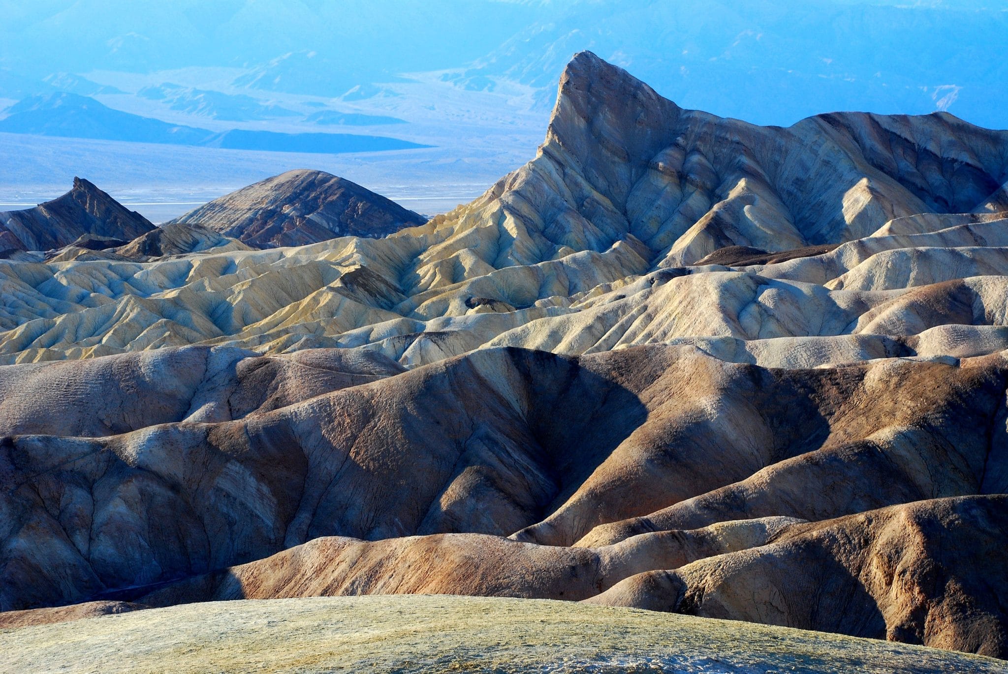
Zabriskie Point
This is one of the park’s most famous and most visited viewpoints. Drive 4.5 miles east of Furnace Creek on SR 190 to the parking lot, then climb a short but somewhat steep trail. The view looks westward past a pointed peak called Manly Beacon to the valley and the Panamint Range.
Here, in the foothills of the Black Mountains, are colorful badlands that were set down along an ancient lakebed, then eroded by flash floods. The color is usually described as yellow or gold, but it can appear bluish-gray or beige depending on the light. Most photographers come here in the very early morning, but I’ve had good luck in late afternoon. You’ll find a restroom in the parking lot.
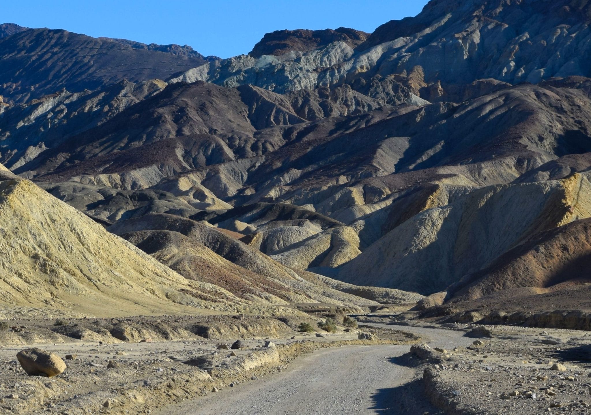
20 Mule Team Canyon
This is a 2.7-mile, one-way drive that gets you up close and personal with badlands similar to those you see at Zabriskie Point. The road is unpaved, but it’s fine for Old Betsy. To get to the starting point, go 1.2 miles east from the Zabriskie Point parking area.
I like this drive. Even during busy times in the park, relatively few visitors venture into the canyon
Badwater Road
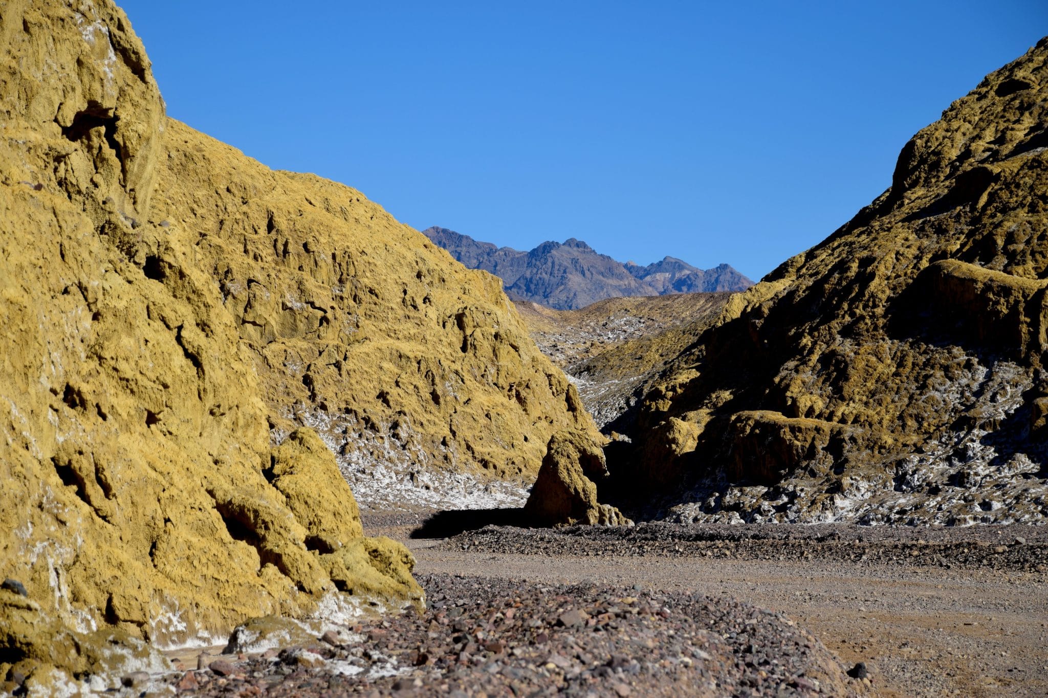
Golden Canyon
There’s no mistaking how this popular trail got its name. You can see the lower end of the canyon in the featured photo at the top of this post. The canyon is the product of various natural processes, including faulting, uplifting, flash flooding and eons of erosion. Photographers will want to visit Golden Canyon in the afternoon, when just about everyone else in the park will be here. This is one of three locations in Death Valley National Park where you may encounter a full parking lot — the others are Artist’s Palette and Badwater.
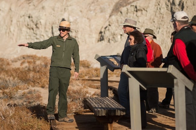
To get to the trailhead, drive 3.2 miles south from SR 190 on Badwater Rd. It’s a 2-mile round-trip with a 300-foot elevation gain. Rangers often lead guided hikes in Golden Canyon.
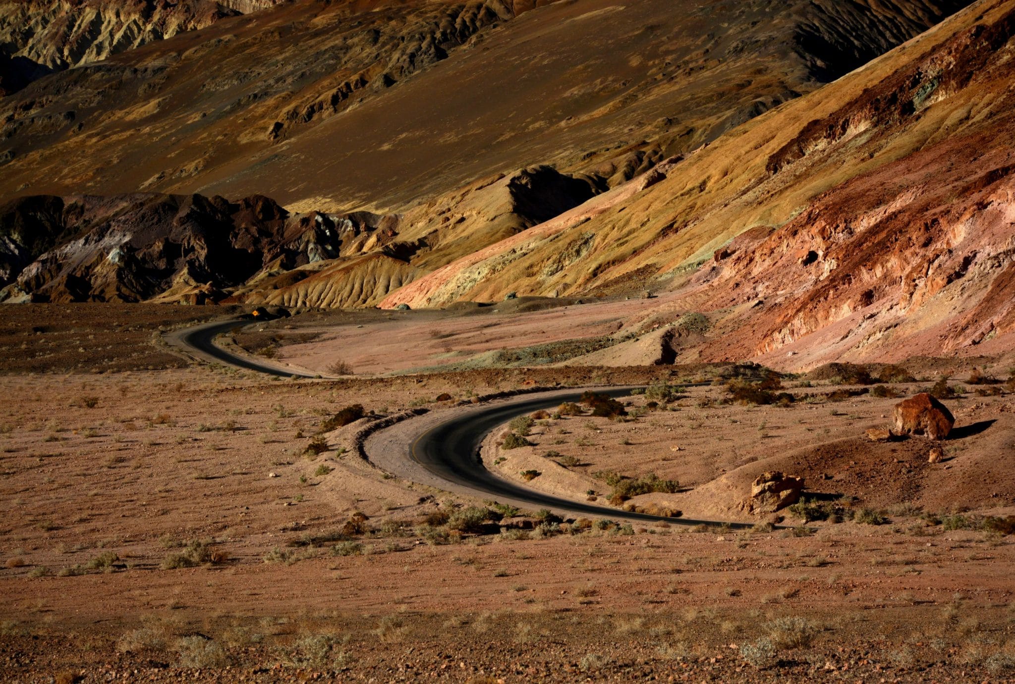
Artist’s Drive
This is probably the most scenic piece of roadway in the park. The narrow one-way road winds 9 miles into the foothills of the Black Mountains past colorful formations, with occasional see-forever views of Death Valley. The most popular stop along the way is Artist’s Palette, where a rainbow of colors appears in the formations. This is another parking lot that’s sometimes full.

To get to Artist’s Drive, head 10 miles south from SR 190, then turn left at the signed junction. The road quickly climbs to a tilted plateau. Take a moment to stop here and savor the view, which looks both north and south.
Badwater
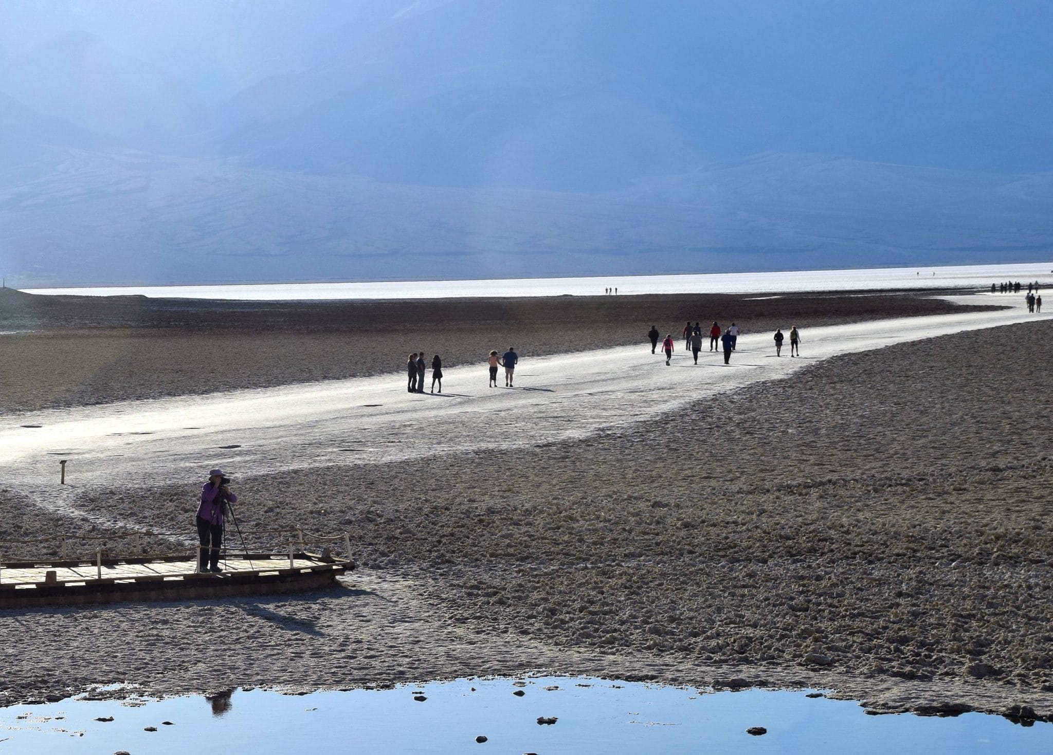
You arrive at Badwater after driving 18 miles south from SR 190. On the right is the parking lot (with a restroom) and a boardwalk leading down onto the valley floor. At 282 feet below sea level, this is the lowest spot in North America. If you look upward to the east, you can see a sign way above you indicating where sea level is.
There’s a spring-fed pool just beneath the boardwalk. From there, a trail leads out onto the dazzling white salt pan. You can walk as far as you like, enjoying tremendous distant views of the valley, as well as up-close looks at polygon shapes in the salt pan. After one of Death Valley’s rare rainstorms, the salt pan becomes a temporary lake that reflects the mountains and sky.
Badwater is the most popular natural attraction in Death Valley National Park. Even on weekdays, there’s usually a crowd here from sunrise to sunset. If the lot is full, don’t lose heart: Continue south, and you’ll come across several other good spots for sightseeing, walking and photography.

Stovepipe Wells area
Stovepipe Wells Village
Death Valley’s second-largest concentration of visitor facilities is along SR 190 about 28 miles west of Furnace Creek, Here, you’ll find a ranger station, motel, campground, RV park, convenience store, 24-hour gas pumps (lowest gas prices in the park), and more. These are the first visitor facilities you encounter if you arrive via Lone Pine or Trona other than the rustic Panamint Springs Resort.
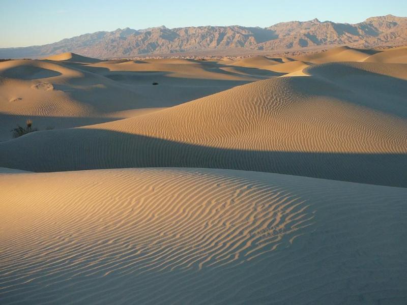
Mesquite Dunes
Thanks to the desert wind, the dunes are constantly changing. If you visit in the afternoon, the view will be different the next morning. You can’t miss the dunefield – it’s strung out along SR 190 east of Stovepipe Wells Village. There are parking spaces all along the way, even though there’s no official entrance. You’re free to wander among the dunes to your toes’ content. Photography is best either very early or very late in the day. No ORVs are allowed on the dunes.
Mosaic Canyon
The canyon, which narrows as you go farther, has walls containing multicolored polished stones. The entrance is at the end of a 2-mile dirt road that leaves SR 190 just west of Stovepipe Wells. Rangers often lead group walks here.
Devils Cornfield
Erosion has resulted in clumps of arrowweed separated by salty sand. It’s right next to SR 190 east of Stovepipe Wells. Park along the shoulder if you’d like to investigate. Most people do a slow drive-by here. Parking is along the shoulder.
Other areas
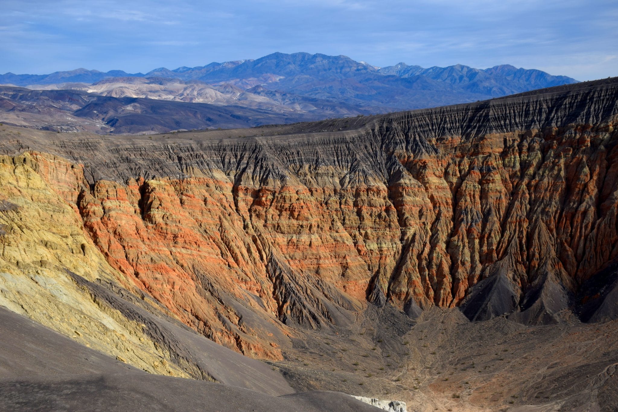
Ubehebe Crater
This is an interesting volcanic crater surrounded by an eerie landscape. The crater is nearly one-half mile across and about 600 feet deep, with walls that turn orange depending on lighting conditions. Feel free to descend into the abyss, but what goes down must come up.
With Scotty’s Castle and Grapevine Canyon closed until 2020, many fewer visitors make it to Ubehebe Crater. To get there, drive 18 miles west from Furnace Creek on SR 190, 33 miles north on Scotty’s Castle Road to the Grapevine Ranger Station, then west 5 miles following the signs. Because Scotty’s Castle and the Grapevine Canyon route to Nevada are closed, you’ll have to backtrack to return to SR 190.

Dante’s View
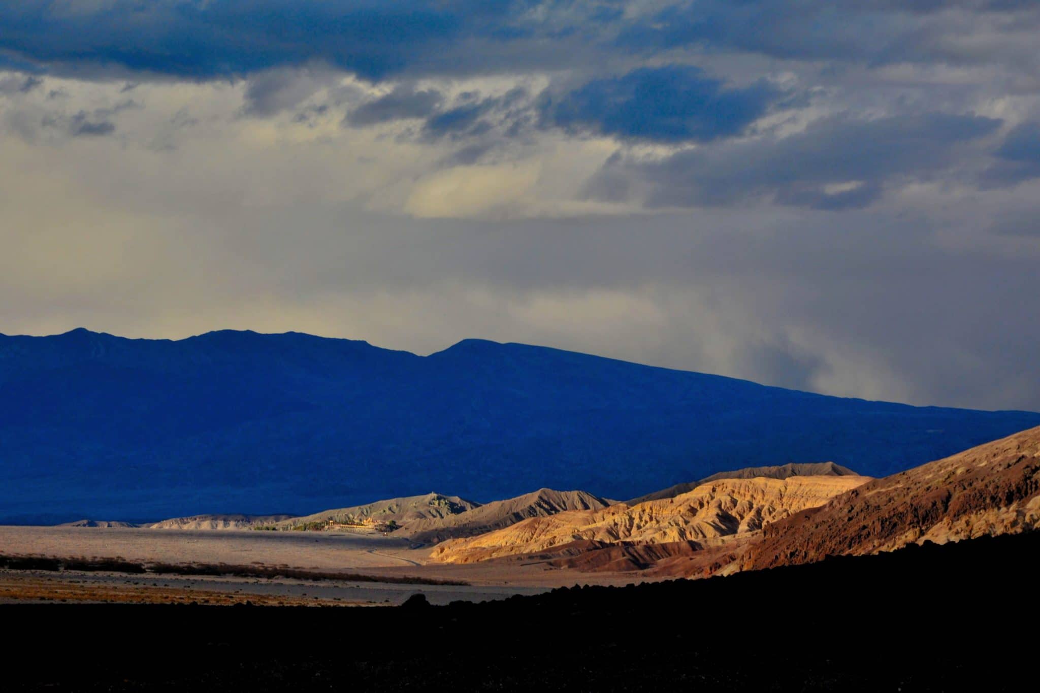
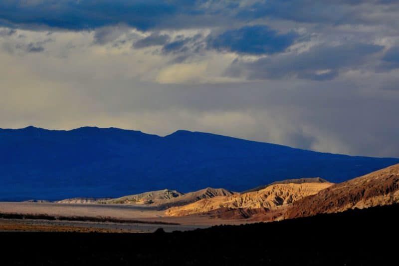
This is the iconic view of Death Valley. Despite its popularity, it’s not exactly a cliché, because a mix of sunlight and clouds insures no two visitors get the same photos. From an elevation of 5,475 feet, you have an amazing 100-mile view that includes Badwater and its salt pans, the full sweep to the north, and the Panamint Range across the valley. Serious photographers arrive here at dawn or earlier. If that’s not for you, come as early in the morning as you can. Stargazers rave about this as a place to view the nighttime sky.
Drive 25 miles southeast from Furnace Creek via SR 190 and Dante’s View Road. It’s uphill all the way, and the narrow road precludes RVs over 25 feet. There’s a primitive restroom ¼ before the viewpoint.
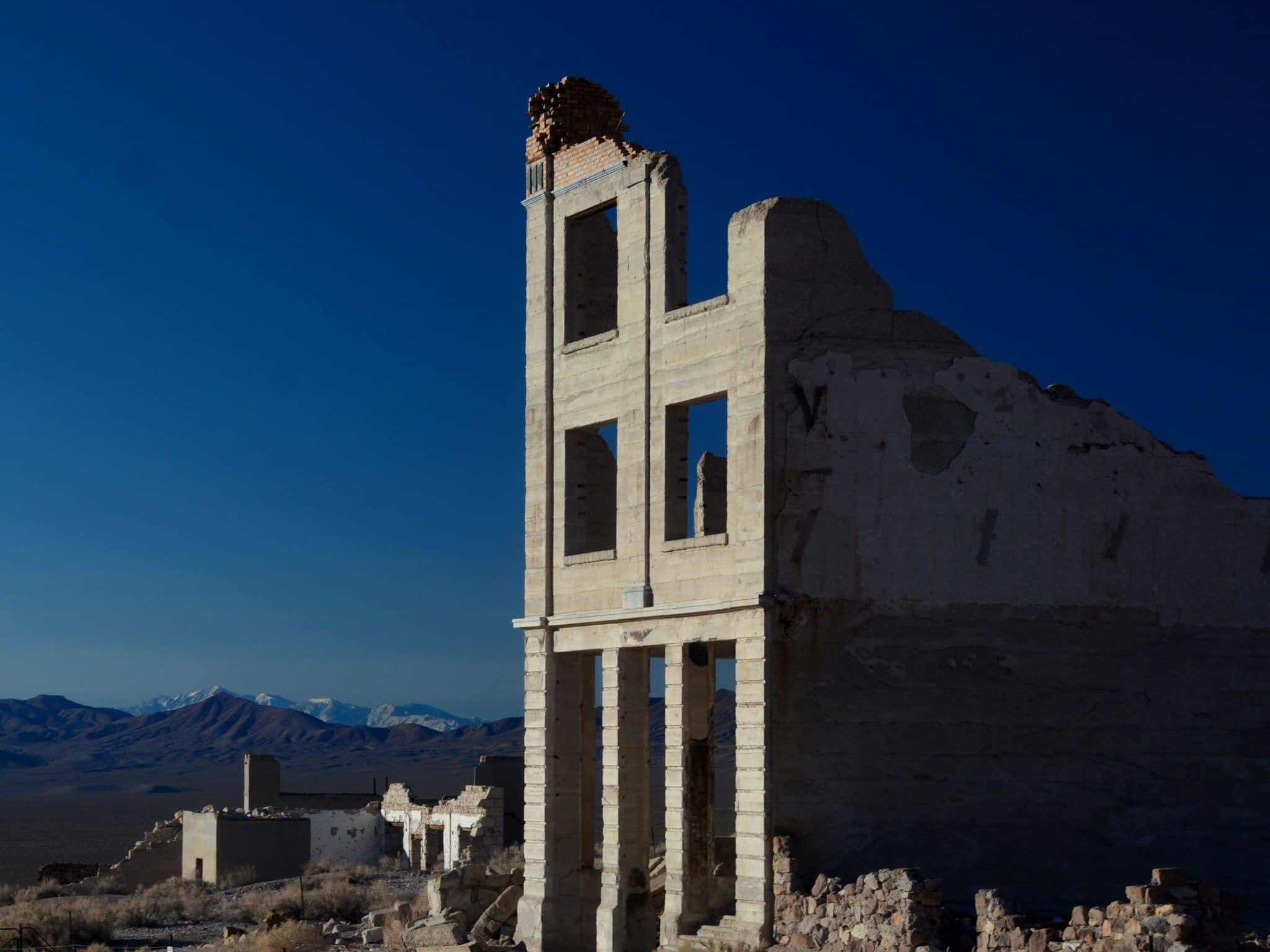
Rhyolite
This is Death Valley’s best ghost town. It’s just off Nevada SR 374 as you head into the national park from Beatty. Rhyolite boomed and busted during the early 1900s. The ruins of several buildings remain. You’ll enjoy a visit here.
Titus Canyon
This is the park’s most popular backcountry road. Portions of the 27-mile route are steep, rough and narrow. A high-clearance vehicle is recommended. If you’re interested, read the description from the park’s web site: www.nps.gov/deva/planyourvisit/titus-canyon
That’s it for our two-part visit to Death Valley National Park. Thanks for joining me! Going forward, our publication schedule is changing. We’ll have a new destination every two weeks. The next one will be published Monday, December 18, and will focus on Utah’s five spectacular national parks.