This is the first of two posts focusing on Death Valley National Park in the California desert.
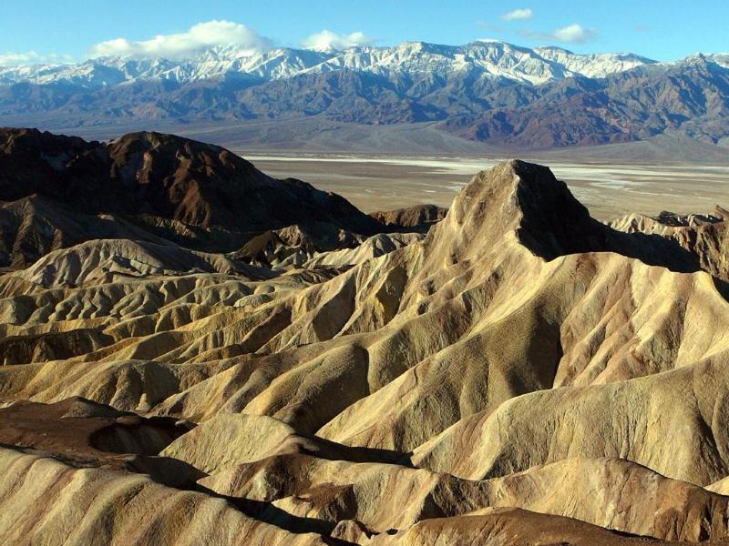
Death Valley is a land of superlatives and contrasts. It’s the hottest, driest place in North America, as well as the largest national park in the lower 48. It contains the lowest place in North America, but it also has a 10,000-foot-high mountain range that’s typically capped with snow from November to May. It’s a place of profound solitude, with 91 percent of its area designated as wilderness. Yet the park receives almost 1.3 million visitors annually and its accommodations and campgrounds are full many weekends and non-summer holidays. Death Valley is especially popular with visitors from overseas, meaning you have a chance to meet people from all over the world here.
Death Valley sometimes goes years with no rain. Yet last year, winter rain brought a generational burst of wildflowers on the valley floor.
Underscoring the park’s morbid name are some of its place names, including Furnace Creek, Funeral Range, Last Chance Mountain, Deadman Pass, Devils Cornfield, Poison Canyon, and Badwater. Yet there’s life here, too. It includes plants and animals that have found ways to adapt and survive in a seemingly hostile environment.
All photos are by Tom Dell except where indicated.
Mother nature is buck naked
In the 19th and early 20th century, mining took place here. It was only minimally successful. The only long-term success came with borate mining. Remnants of mines can be found throughout the park. People live here today, too – not just park rangers. Death Valley is an ancestral homeland of the Timbasha Shoshone, who have a small village in the Furnace Creek area.
In this week’s post, I’ll focus on such visitor concerns as how to get here, when to come, where to stay, and what makes Death Valley a special place worthy of being a road trip destination.
Next week, in Part Two, we’ll consider the park’s specific attractions – the must-see places, as well as some that aren’t on most visitors’ radar.
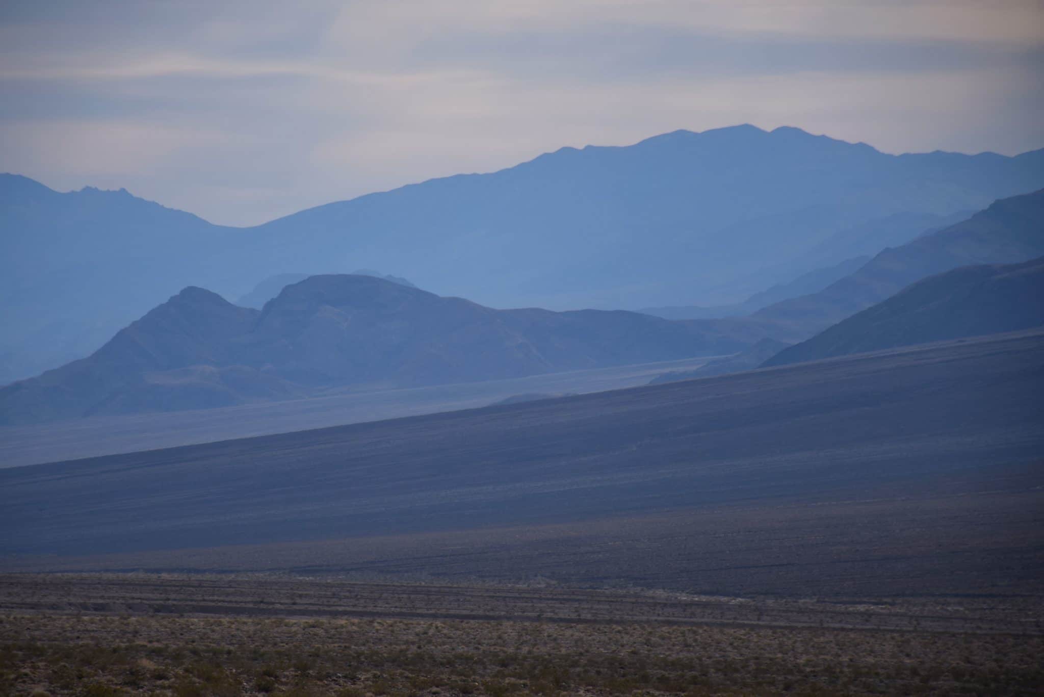
Aridity is the key to what you see when you come to Death Valley National Park. The prevailing westerly winds that flow onto the west coast of North America are forced upward when they meet the Cascades and Sierra Nevada. When they cool, they release precipitation in the form of rain and snow. On the east side of these mountains is a very dry “rain shadow” extending almost to the Rocky Mountains.
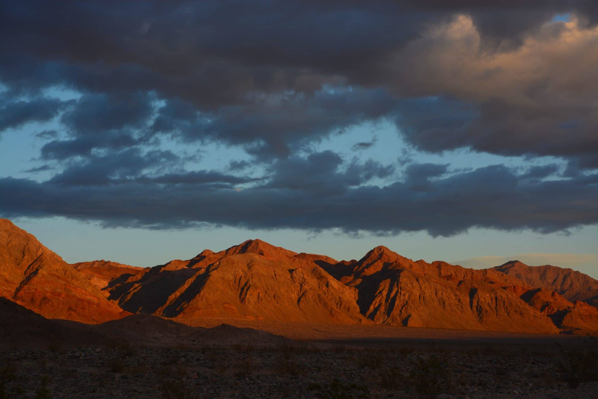
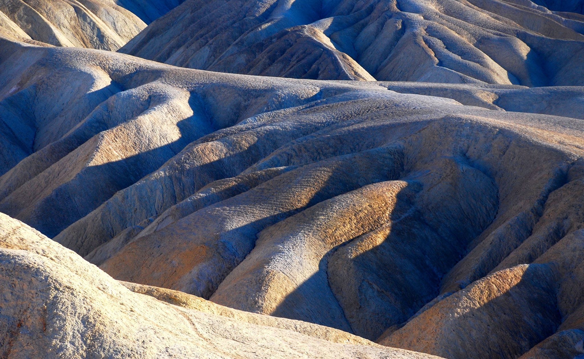
Any moisture still in the clouds that head toward Death Valley falls in the Panamint Mountains just west of the valley, creating a desert’s desert. With so little vegetation other than low scrub here and there, your first impression when you descend into the valley is that Mother Nature is buck naked here.
Lucky camera
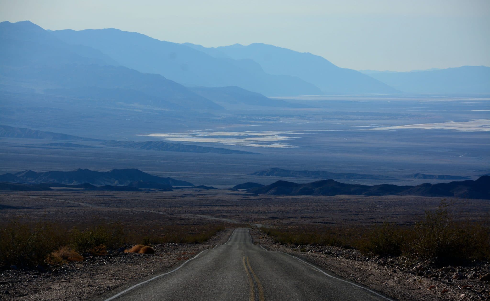
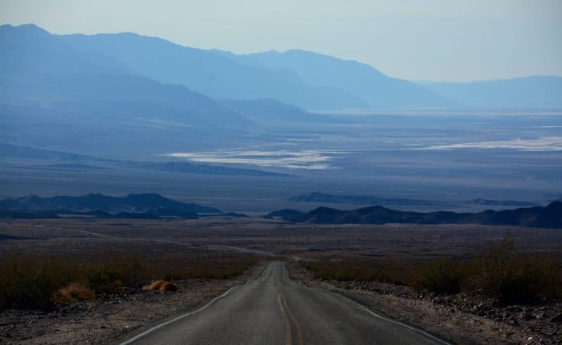
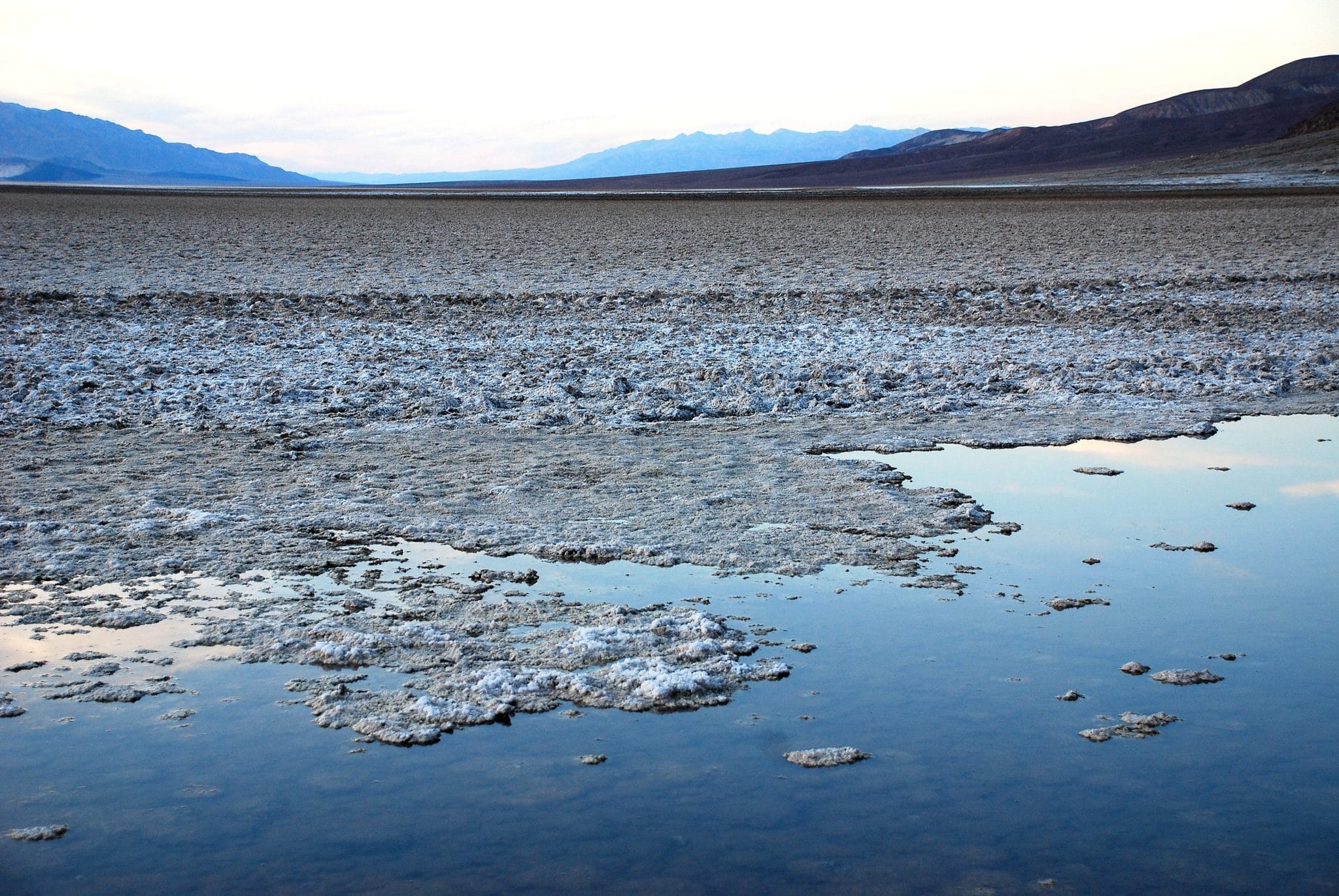
What you see instead are the results of the area’s complex geology – the flat valley bottom with cracked salt flats, bordered by bare, deeply eroded mountains and canyons.
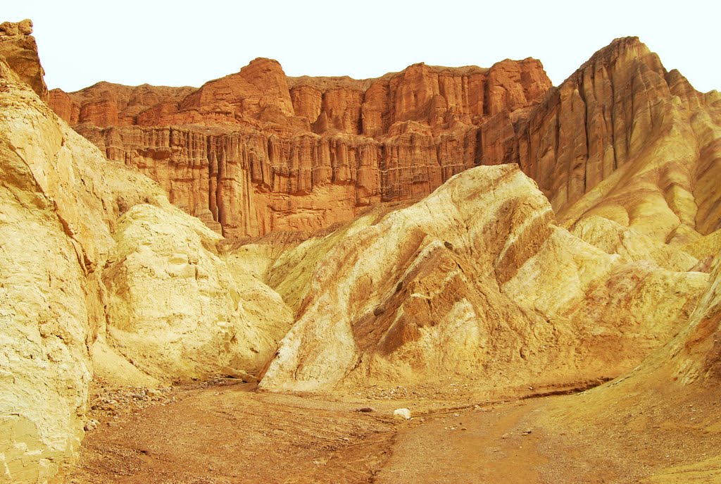
The colors aren’t as vibrant as what you see in Utah’s canyon country, but it’s still colorful. When clouds are present, the skies are dramatic, especially during what photographers call “the golden hour” – which is on either side of dawn and sunset. I especially like the soft mustard- and buff-colored formations in the Furnace Creek area, as well as Golden Canyon and Artist’s Palette.
As a traveler who likes to lug a camera around, I have a special love of Death Valley. For some reason that certainly includes luck, I’ve never come home from this park without some very special photos. Some are in this post.
Let’s consider what you need to know when planning a visit to Death Valley. When you come depends on weather conditions, the availability of accommodations, when you have time to travel, and your personal preferences.
The park’s web site is a good resource. You’ll find it at www.nps.gov/deva. Another is the AAA Guide to Death Valley National Park, which is available to AAA members at offices in California and Nevada. The Auto Club map is probably the best road map of the area.
This is a very much a seasonal place. The weather is generally sunny and dry most of the year. The most popular months are February through April. Winter storms occasionally occur in winter and early spring. You might need a light jacket during these times, but by springtime, most visitors wear shorts. Summer is another story. This is one of the world’s hottest places. Temperatures can reach 120 degrees, with lows in the mid-90s.
Not a day trip
Do people come here during the summer? Yes. Maybe they’re masochists or just curious. During my only summer visit, I met quite a few Germans. Many years ago, I was invited to join a group of Hyundai engineers for hot weather testing of competitive minivans. Damn, it was hot! While the engineers studies the vehicles’ technical features, I ranked the vans on how good their air conditioning systems were. We weren’t alone; we saw convoys of test vehicles from both BMW and Mazda. (The National Park Service no longer allows manufacturers to do testing here.)

Even though the park is in California, it’s not a day trip for most people The only major city close enough to make a day trip feasible is Las Vegas. From Los Angeles and San Diego, you have several choices of routes. For details, go to www.nps.gov/deva/planyourvisit/directions From Phoenix, use the route from Las Vegas. From northern California, use the route via Baker. From other points in the United States, go via Las Vegas.
If I’m headed for Furnace Creek, I use the I-15-Baker-SR 127 route (280 miles). You should also use that route if you want to begin at the park’s visitor center. For Stovepipe Wells (a good place to begin one’s sightseeing), I use the following:
- I-15 to Hesperia
- US 395 to Randsburg
- Trona road to SR 178 – becomes Trona-Wildrose Rd.)
- East on SR 190 to Stovepipe Wells
High gas prices
Because of the distances involved, you’ll need to stay overnight. If you’re camping, go to www.nps.gov/deva/planyourvisit/camping. You’ll find information on sites, facilities, fees and advance reservations.
There are four lodging establishments inside the park. Go to www.nps.gov/deva/planyourvisit/lodging. Rooms in the park are hard to come by on weekends December through April. You can sometimes find a room in Lone Pine or Baker, but it’s a long drive. My personal preference is the Best Western in Pahrump, Nevada.
You can get food at all these locations, plus Indian tacos at the Timbasha Shoshone Village near Furnace Creek. How about gas? You’ll find it at Furnace Creek, Stovepipe Wells and Panamint Springs, as well as the nearby town of Shoshone. Be prepared for the highest gas prices you’ve ever paid!
Death Valley’s entrance fee is $25 for autos and $15 for motorcycles. Instead of entrance stations, the park has kiosks where you can pay your fee. You can also pay at the Furnace Creek Visitor Center or the Stovepipe Wells Ranger Station.
Lastly, you should be aware that your cell phone probably won’t work here. Can you survive without it?
Ready to go to Death Valley? Please return next week as we consider how you might spend your time in the park.