This week’s destination for Road Trips with Tom is Joshua Tree National Park, located 140 miles east of Los Angeles and 175 miles north of San Diego.
As a lifelong Southern Californian, I’ve made at least a dozen visits there, beginning with Boy Scout camping expeditions many, many years ago. My most recent visit was February 24, in preparation for this week’s post.
On that trip I got a bit of a surprise: Joshua Tree was crowded! It was a weekday in winter, but the park was full of people. I got up early so I could get a ticket on the ranger-led hike to Keys Ranch – you have to buy your ticket in person at the visitor center in Twentynine Palms. I was there by 9:45, but I barely made it — I got the very last of the day’s 25 tickets. At the entrance station, a sign said all eight of the park’s campgrounds were full. And at the parking area for the Hidden Valley Nature Trail, it was so crowded that the National Park Service had someone directing traffic.
I’ve never experienced such a crush of people in this park before. A ranger at the visitor center told me the park’s campgrounds had filled up every day since December.
Why so many? Well, for one thing, it’s the closest national park you can drive to for 21 million people. Yet about half the vehicles I saw had out-of-state plates, most from cold places like Minnesota and Canada.
For another thing, the visitor season is limited. Summers are seriously hot here, so you’ll want to avoid June-September unless you want to fry your brains.
For yet another thing, Joshua Tree is a very special place.
A special place
What’s special about it?
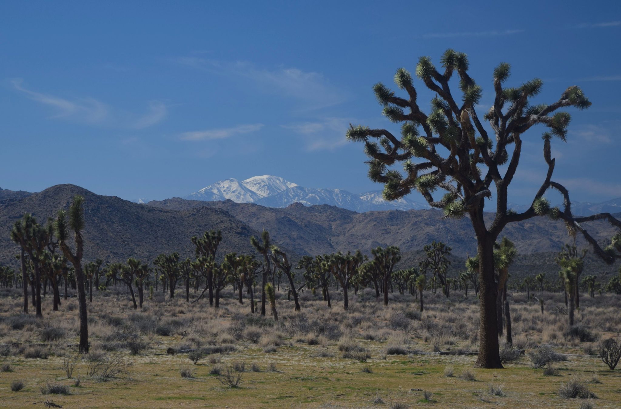
- It’s a showcase for the unique Joshua Tree, which isn’t a tree at all, but rather a member of the agave family and a distant relative of the pineapple. Joshua Trees grow only in the Mojave Desert of California, Nevada, Arizona and the far southwest corner of Utah. In the park, Joshua Trees can be found in the western half at an elevation of 4,000 feet or so.

- It encompasses the boundary between the Colorado and Mojave Desert – two distinctly different ecosystems. You can experience both as you drive through the park. The western part is the Mojave, and the eastern half is the Colorado Desert.
- It offers world-class rock climbing, thanks to the giant granite boulders you’ll find in the park’s western side.
- There’s a drive-to viewpoint where, on clear days, you can see all the way to Mexico.
- It has 900 miles of hiking trails, ranging from short nature trails to challenging backpacking routes.
- In Joshua Tree you’ll find an extensive network of backcountry roads ideal for 4WD vehicles and mountain bikes.
- It has eight campgrounds, plus one only for groups and two just for equestrians.
- You’ll also find three visitor centers, a nature center, and a full schedule of ranger-led activities.
National Park Service visitation numbers bear out my observations. In 2016 Joshua Tree attracted 2 ½ million people – a 24 percent increase over the prior year. Visitation has nearly doubled since 2011, and Joshua Tree is now second only to Yosemite in popularity among California’s national parks.
Must-see attractions
Bottom line: Joshua Tree is well-worth visiting, but you’ll need a strategy to get the most out of your visit. I’ll get back to that a bit later, but let’s first look at how to get there and what specific attractions you’ll want to check out in the park.
From urban Southern California, drive east toward Palm Springs on I-10. When you encounter the giant forest of wind turbines, take Exit 117 for SR 62 and drive through Yucca Valley. The park headquarters and main visitor center are in Twentynine Palms, 43 miles from I-10.

To see the park’s highlights, I recommend you enter the park from the town of Joshua Tree, where you’ll find a small visitor center. That’s the west entrance. There, you pay your $25 per vehicle entry fee ($12 for motorcycles). Almost immediately, you’re in a forest of Joshua Trees that frame mountains of boulders – probably the park’s most appealing landscape. Keep an eye peeled for rock climbers.
The high point is the Hidden Valley area, where you’ll find the park’s best nature trail. The trailhead for the one-mile hike is the Hidden Valley Picnic area, accessible via a well-signed side road on your right. Hidden Valley is a Joshua Tree-studded valley surrounded by boulders; it reputedly was used by cattle rustlers way back when.

Don’t hug the cholla
Immediately beyond that junction is a side road on your left leading to Hidden Valley Campground, Keys Ranch (ticket required) and the popular trail to Barker Dam, a water catchment built by early cowboys.
The next side road you’ll want to take is the 5-mile road to Keys View. At 5,000 feet, the viewpoint overlooks Mt. San Jacinto, Mt. San Gorgonio, the Coachella Valley and the Salton Sea. On very clear days, you can see Signal Mountain in Mexico.

A few miles later, there’s a trail to Skull Rock, a formation resembling a human skull. It’s actually visible from the parking area alongside the roadway.
Soon, you’ll arrive at a junction. Turn left for Twentynine Palms and the park exit. If time permits, continue straight for 10 miles. In that distance, you’ll descend into the Colorado Desert. Joshua Trees disappear, replaced by creosote scrub. You can continue all the way to the small Cottonwood Visitor Center and, just beyond that, Interstate 10. You’ll want to stop after 10 miles at the Cholla Cactus Garden (pictured) and the Ocotillo Patch. Chollas have a cuddly appearance from a distance, but their barbed spines are hell to remove from your skin or clothing. The ocotillo is a spiny plant that displays bright red flowers shortly after a rainfall.

Joshua Tree’s paved roads are for leisurely travel, with speed limits ranging from 25 to 45 mph. Along the way, you’ll find lots of turnouts with exhibits highlighting the ecology and history of the areas you’re viewing. Many turnouts have pit toilets.
Lonely homestead
I’ve skipped over Keys Ranch so far, but it’s one of the park’s highlights. William Keys and his wife, Frances, homesteaded in this lonely desert location. Keys had a remarkable skill set that enabled him and his wife to raise four children here. It’s a fascinating place to visit, but you can only go there on a ranger-guided tour.

To get your ticket ($10 extra), you must go in person to the Oasis Visitor Center in Twentynine Palms (open daily 8:30-5) on the day you want to visit the ranch. The ranch tour is at 2 p.m. Thursdays, Fridays and Saturdays only. As I mentioned earlier, these tours fill up quickly, and you’ll need to get to the visitor center early to get a space.

Your strategy for visiting Joshua Tree
Before firing up Old Betsy and heading for Joshua Tree National Park, spend some quality time with the park’s website: www.nps.gov/jotr. I also recommend the video preview at www.youtube.com/watch?v=ttERleduULA.
Here are some tips:
- If you can, come on a weekday. Weekends and holidays from now to May and from October into 2018 will be crowded.
- Get there early. Mornings are the least crowded time of day.
- Unless you’re camping, reserve a room in Yucca Valley or Twentynine Palms. Both towns have lots of places to stay and eat. There are no lodges, restaurants or stores inside the park. If you want to take the Keys Ranch tour, stay in Twentynine Palms, so you can be at the Oasis Visitor Center when it opens.

- If you’re camping, you can reserve a space up to six months in advance at the Black Rock and Indian Cove Campgrounds. Both are accessed directly from SR 62. The park’s website has a link for reserving campsites. On the day I visited, despite the entrance sign about campgrounds being full, I saw a few unoccupied sites in the Belle and Ryan Campgrounds.
- Bring bottled water. This is the desert, and you’ll need a gallon per person per day. In the park, water is only available at visitor centers and two of the campgrounds.
- Except in summer, dress in layers. When I visited in late February, the temperature was in the 30s when I arrived and the low 50s in the afternoon.
Thanks for visiting Road Trips with Tom. Next week, if the weather cooperates, I’ll have an article covering “The Loneliest Road in America” – US 50 in central Nevada.

