
This week, Road Trips with Tom visits California’s Lassen Volcanic National Park. Mt. Lassen is the southernmost end of the Cascade Range – a chain of volcanoes extending 700 miles into British Columbia. Until Mt. St. Helens literally blew its top in 1980, Mt. Lassen was the last Cascade volcano to erupt. That was in 1915. The legacy of that eruption is evident in the many thermal features still active in Lassen Park. Mt. Lassen may be dormant, but it definitely ain’t dead.
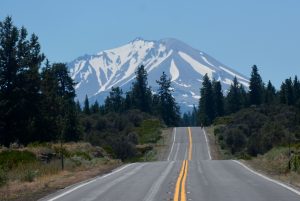
Like Mt. Shasta, which we visited a couple of weeks ago, Lassen is almost always visible for many miles in every direction, thanks to California’s near-constant clear skies. But at 10,457 feet, Mt. Lassen is Mt. Shasta’s little brother, standing nearly half a mile shorter. However, Lassen is the focus of a very appealing national park far enough off the beaten track that you can enjoy a summertime visit without dealing with huge crowds.
A great starting point for visiting Lassen Volcanic National Park is the park’s website – www.nps.gov/lavo.
Lassen Park is worthy of being a primary road trip objective, yet it can be coupled with visits to such other destinations as Crater Lake, Mt. Shasta and Lava Beds National Monument. You could easily spend several days at Lassen, but it’s compact enough that you can check out the displays at the visitor center, drive the 30-mile scenic road, and hike a couple of trails in 4-5 hours.
What to do there? Auto touring is the most popular activity. You’ll also find over 150 miles of hiking trails. Only the summit and Bumpass Hell trails get substantial visitor traffic. For a guide to hiking trails, go to the park website, click on Things to Do, then Hiking. Manzanita Lake is also good for kayaking or canoeing.
Lassen is a very good camping park, with two large, well-equipped campgrounds. Lodging, however, is another matter. We’ll get back to overnight options in our Logistics section farther down the page.
South to north
The park’s layout presents you with a dilemma. If you enter the park from the north, as I did in late July, you’ll have nice scenery that gets even nicer as you drive south, reaching its zenith near the park’s southern end. Unfortunately, the visitor center, where I suggest you begin your visit, is also near the park’s southern entrance. As a result, I recommend you travel the park from south to north.
The park road is SR 89, which traverses just about nonstop great scenery for nearly 400 miles from Mt. Shasta to the Eastern Sierra by way of Lake Tahoe. In Lassen Park, there are a couple of backcountry roads that enter the remote east end of the park, but I’d guess that 99 percent of the 468,000 annual visitors stick to the main road.
Rotten eggs
The park entrance is on SR 89 a few miles north of SR 36. After paying your $20 entrance fee ($15 for motorcycles), start your visit at the visitor center, which has the oh-so politically correct name of Kohm-Yah-mah-nee. (No, I’m not kidding.) It’s open 9-5 daily from April 1 to October 30, 9-5 Wednesday-Sunday the rest of the year. Inside, you’ll find the usual video program and displays, along with a café and gift shop.
Be sure to spring for the road guide to the scenic drive. There’s also an audio tour containing less detail but downloadable to any MP3 device. Pick up the free app at the visitor center.
Your first stop is Sulphur Works, a small thermal area that announces its presence with clouds of steam and the smell of rotten eggs. This is the only place in the park where I couldn’t find a parking spot during my July visit. A few more miles brings you to the parking lot for the Bumpass Hell trailhead. A 3-mile round-trip hike will take you to the park’s largest thermal area, complete with hissing steam vents, bubbling mudpots and more rotten egg odor.
Take it to the top
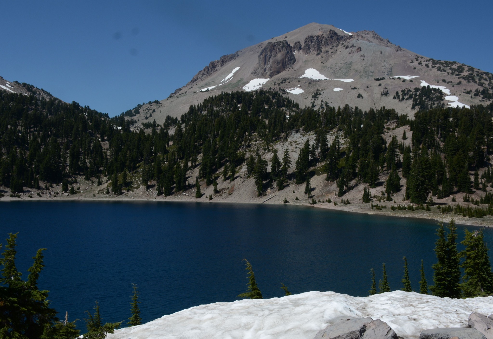
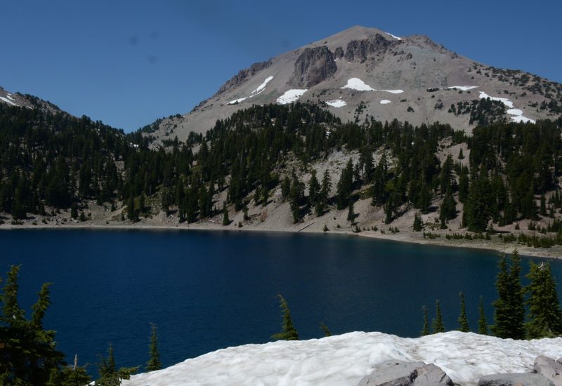
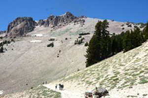
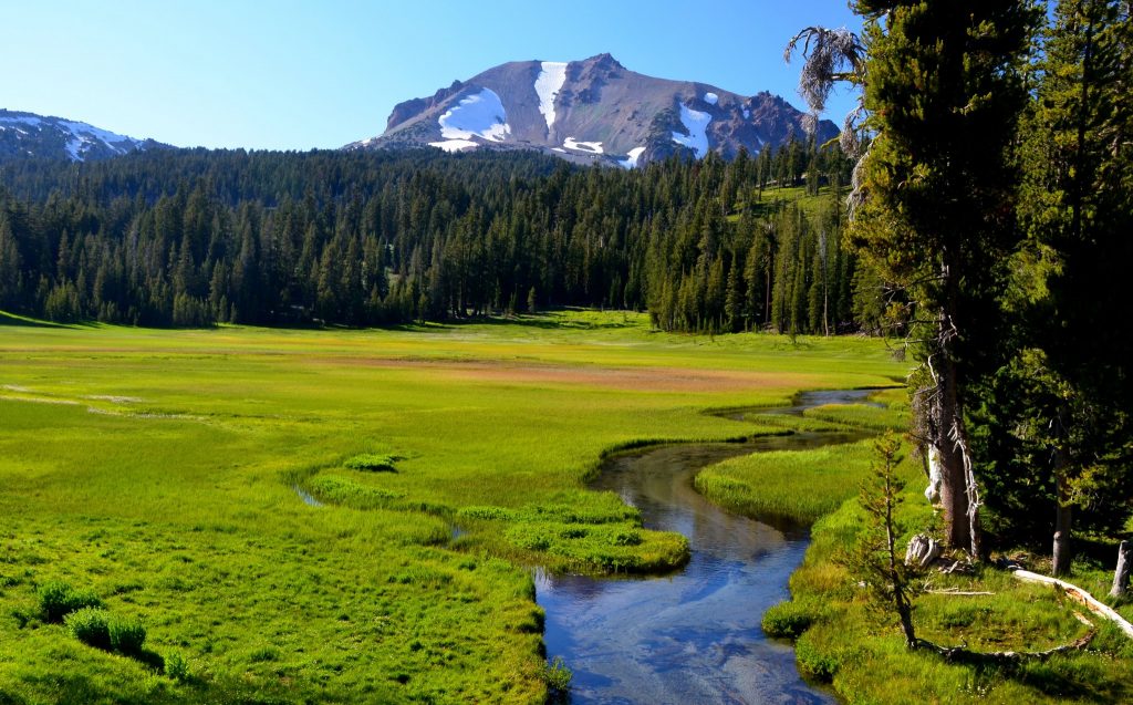
You’ll find a nice photo op at small Lake Helen, where Lassen Peak is reflected in the water in calm weather. This view is shown (without reflection — too windy) in the photo at the top of this post. Shortly beyond the lake, you arrive at the road’s high point at 8,512 feet. You’re clearly on the mountain at this point. There’s a large parking lot (with restroom) on your left, where you’ll find the trailhead for the 2.5-mile trail to Lassen’s summit. Feeling frisky?
The road now descends steadily to beautiful Kings Creek Meadow, another excellent photo op, with a clear stream meandering through a green meadow, and Lassen Peak in the background. Very nice.
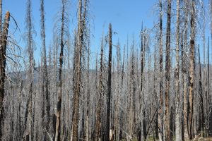
There are other stops along the scenic drive, but I’ll point out just one – the Devastated Area. Here, you can see the effects of the 1915 eruption, which destroyed an entire forest. Take the short trail beginning at the parking lot.
Just before the park’s exit is Manzanita Lake, which has Lassen Park’s largest campground, as well as the Loomis Museum, which contains more displays on the park and the eruption. It’s open 9-5 daily until October 30. Frankly, if you viewed the displays at the main visitor center, you can skip this one. At Manzanita Lake, there’s a store with gas pumps. The store rents kayaks and canoes.
Logistics
Lassen Volcanic National Park can be reached in a day from the San Francisco Bay Area, Reno or Portland, but from Southern California, figure on 1 ½ days.
Lassen is a great camping park. The park has two large campgrounds – Manzanita Lake, at the park’s north end, and Summit Lake, about midway between the two entrances. Manzanita Lake, which has 179 sites at an elevation of 5,890 feet, is open from May 27 until snow closes the road. Sites are $24 per night, and about half the sites are reservable, while the rest are on a first-come, first-served basis. To reserve a site, go to http://recreation.gov/ or call (877) 444-6777. Summit Lake, at 6,695 feet, has 94 sites and is open in summer only (July 1 to September 13). Sites are $22 or $20, depending on the type of toilet in a particular loop. It, too, offers reservable sites. Use the same web site or phone number I gave you for Manzanita Lake.
Not camping? There are some small, iffy motels in nearby towns, but for a decent choice of accommodations, you’ll need to stay in Redding, Red Bluff, Chico or Susanville, then commute to the park. My recommendation is Red Bluff, which is on I-5 at Exit 649. There, you’ll find an array of motels and restaurants. It’s about an hour’s drive from Red Bluff to the Lassen visitor center via SR 36 and SR 89.
Geologists tell us there’s a reasonable chance another Cascade volcano will erupt during our lifetime. Will it be Lassen?
Thanks for visiting Road Trips with Tom. In our next post, which will publish on Sunday, August 28, we’ll head to Old Sacramento State Historic Park, which features the California State Railroad Museum.