This week’s road trip is a short one – just 44 miles on Utah SR 128. It’s short, yeah, but this is a special road trip that packs a big scenic wallop. It’s one of the finest scenic drives in North America.
Our post, as a result, is somewhat light on text and heavy on visuals. My photos should give you a good view of that scenic wallop.
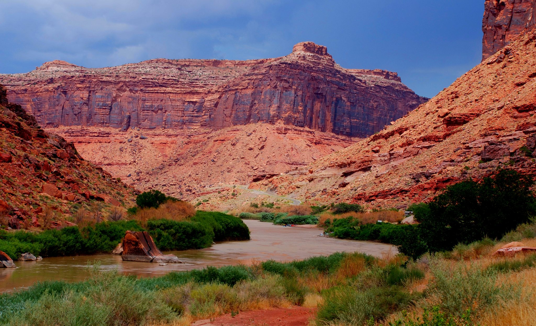
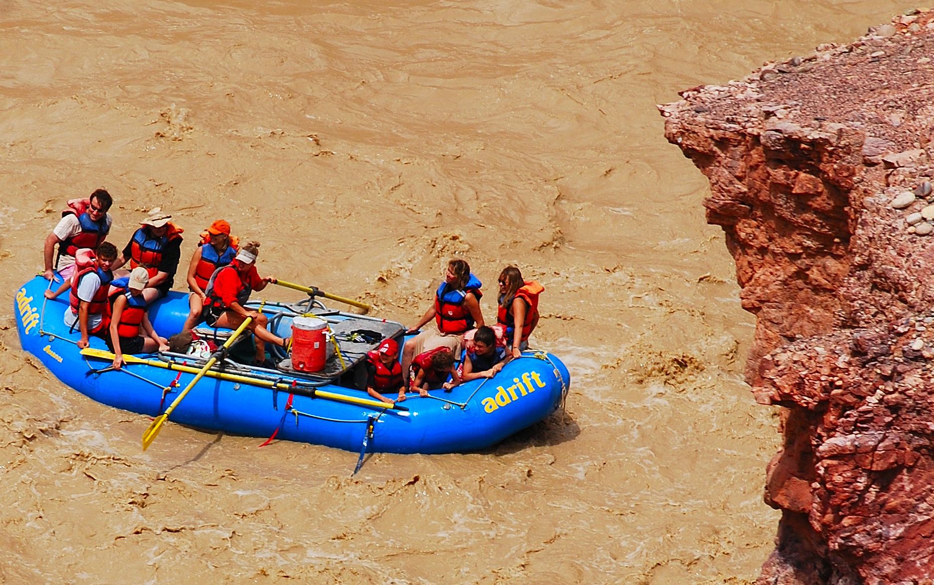
Like much of southeast Utah, this is a wilderness of red rock. What makes it extra special is the Colorado River. Along with the adjacent Potash Road, this is the first place north of Laughlin, Nevada, and the only place in Utah where you can drive along the Southwest’s signature river. The Colorado flows through country so rugged that there’s only one other bridge crossing in the entire state.
SR 128, known officially as the Upper Colorado River Scenic Byway, begins at Moab – southeast Utah’s recreational hub. Of course, this is one of many reasons you should consider spending at least three to five days in Moab – more if you’re a mountain biker or a 4WD explorer.
A few options
SR 128 branches off US 191 just a couple of miles north of Moab and heads northeast. It takes you to I-70 at a point 27 miles from the Colorado border and 47 miles from Grand Junction. In addition to being one of the country’s most scenic drives, SR 128 serves as a shortcut if you’re headed from Colorado to Moab or vice versa. And it’s short enough you can drive it from end to end, then turn around and drive it again in the other direction. I’ll offer up a third option as we move through the road log.

You can drive SR 128 in an hour, but why would you? Stop for photos. Have a picnic. Take a hike. Be aware, however, that there are no services along SR 128, so be sure to bring whatever you’ll need.
SR 128 is suitable for all vehicles. You’ll need to exercise special care in places if you’re in an RV or on a bicycle. Traffic is generally light to moderate. I recommend you begin in the morning. Even though you’ll be heading toward the sun, the light and colors will provide breathtaking photo ops. Of course, late afternoon is nice, too.
The land across the river is part of Arches National Park. However, there is no park access from SR 128. The entrance is off US 191 just north of the river crossing.
Oh, if you’re a fan of Google Street View, you’ll find the entire route there. And for a YouTube preview, go to www.youtube.com/watch?v=5ADSuvAnfN0.
SR 128 road log
Start by driving north out of Moab on US 191. Just before the bridge across the Colorado, you’ll arrive at the junction with SR 128. There’s now a traffic signal at the junction. Turn right here to begin your scenic adventure. Be sure to reset your trip odometer.
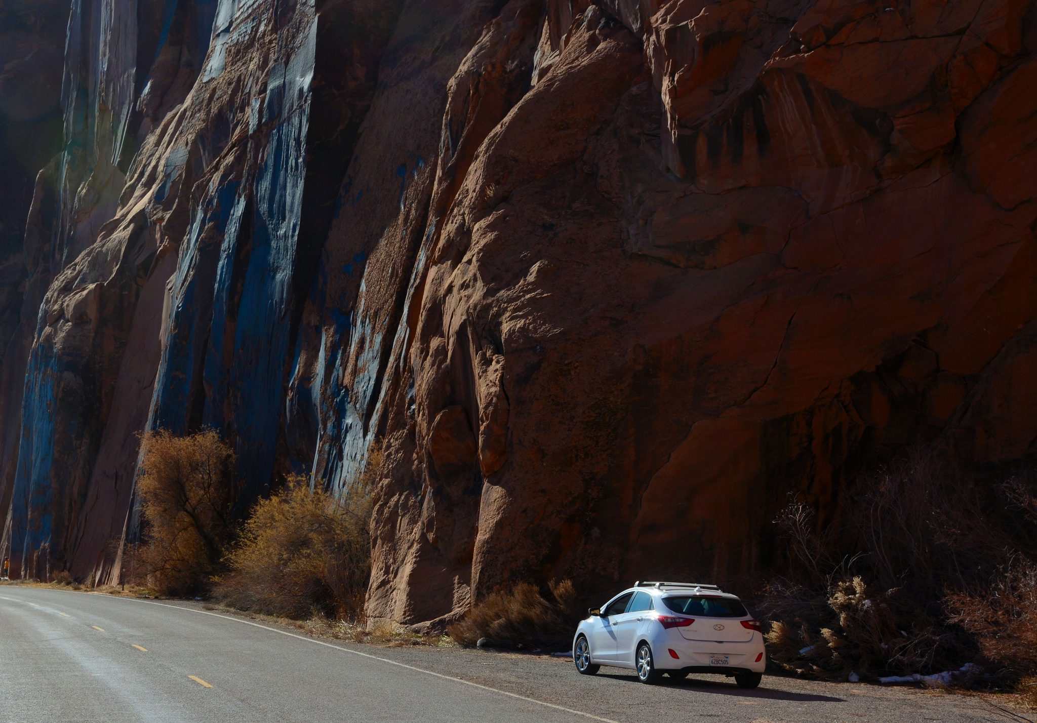
Mile 0.0 Right at the junction is Lions Park, a rest area with picnic tables and restroom. For the first 13 miles, SR 128 traverses a narrow gorge, wedged between the river and 2,000-foot cliffs of reddish stone. Traffic tends to cluster here because the highway demands reduced speeds. The terrain and traffic will open up once you’re past this section.
Mile 3.1 Negro Bill Canyon and trail on the right. A two-mile hike will take you to Morning Glory Natural Bridge (I’ve not made this hike).
Mile 14.0 Crossing of Castle Creek. Several Western movies were filmed in this area. Look around – see anything familiar?
Optional side trip via Castle Valley Rd.
Mile 15.5 Junction with Castle Valley Road. This is a highly scenic byway that climbs onto the shoulder of the La Sal Mountains, eventually leading back to US 191 south of Moab. A portion is unpaved, but it should be passable in whatever you’re driving. This route is an option if you’re driving SR 128 to its end, then returning to Moab.
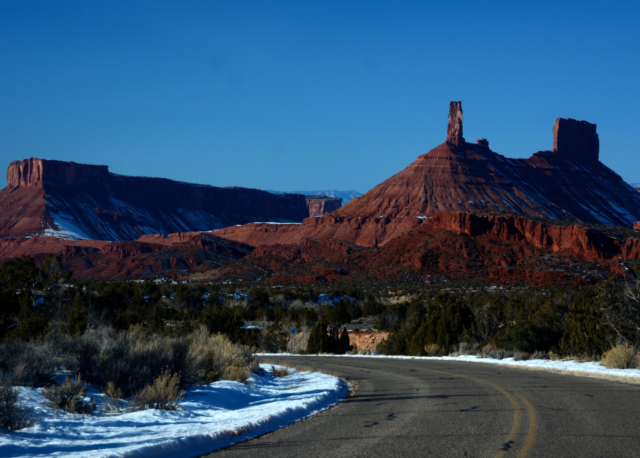
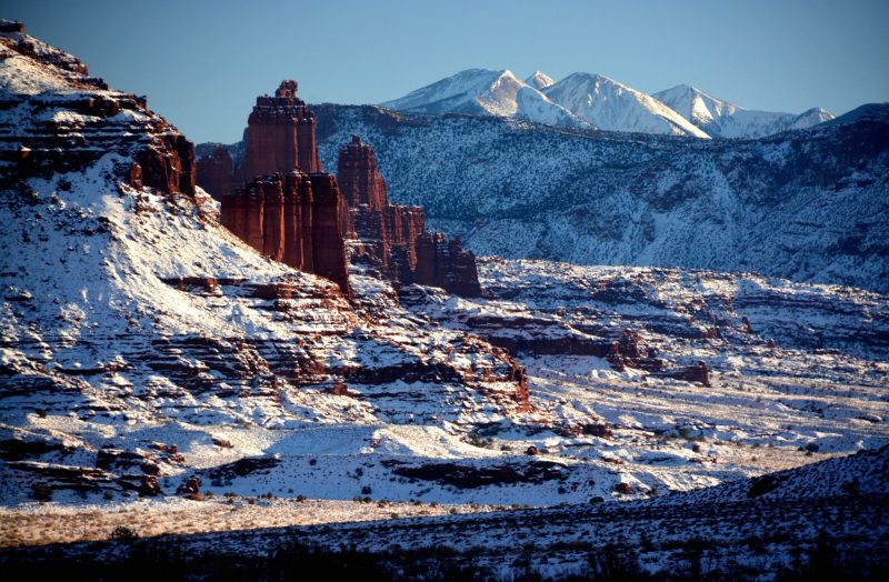
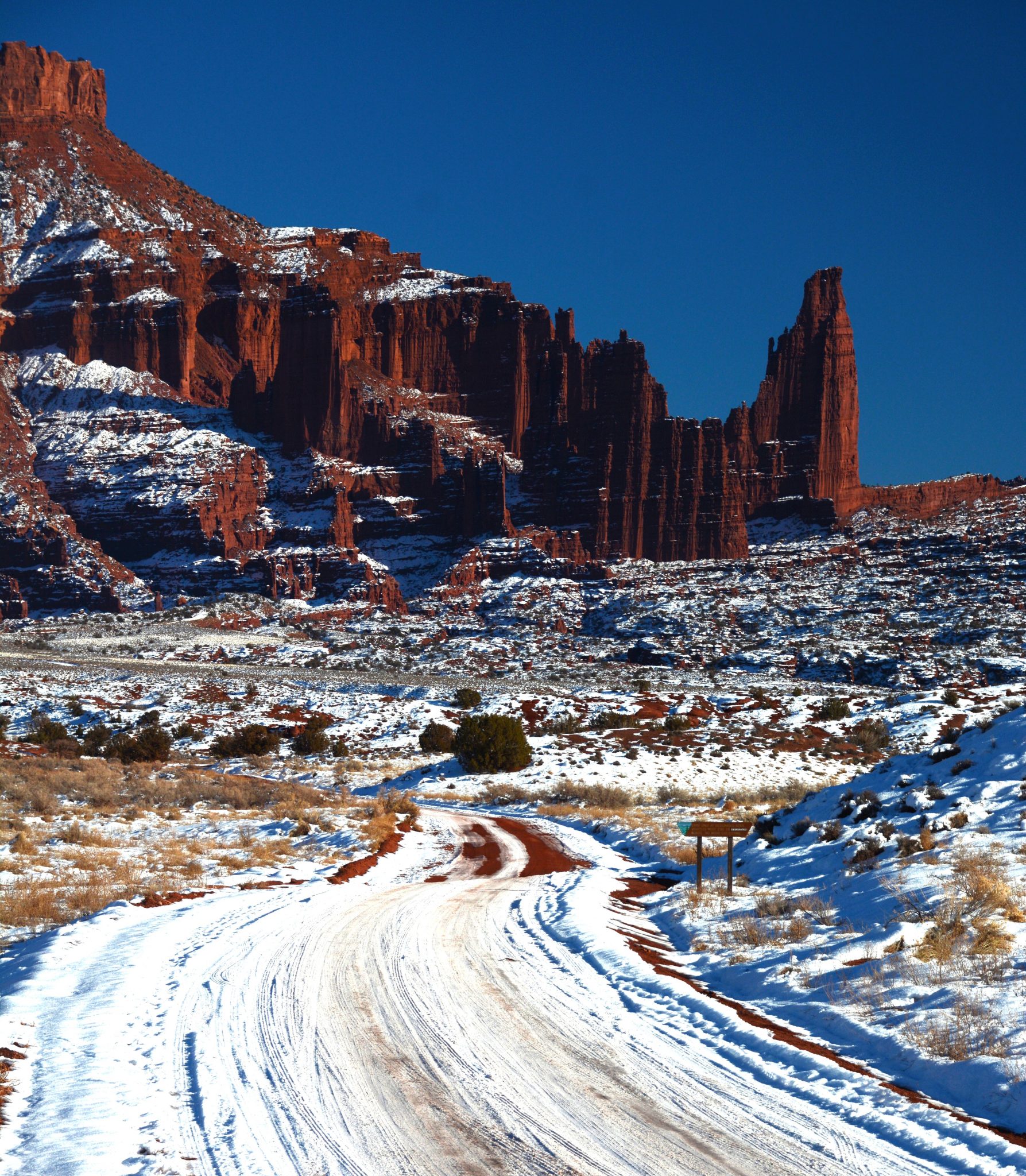
Mile 21.0 On your right are the Fisher Towers – gigantic basalt columns. The largest, named Titan, is 900 feet high. A dirt road leads to the trailhead at their base.
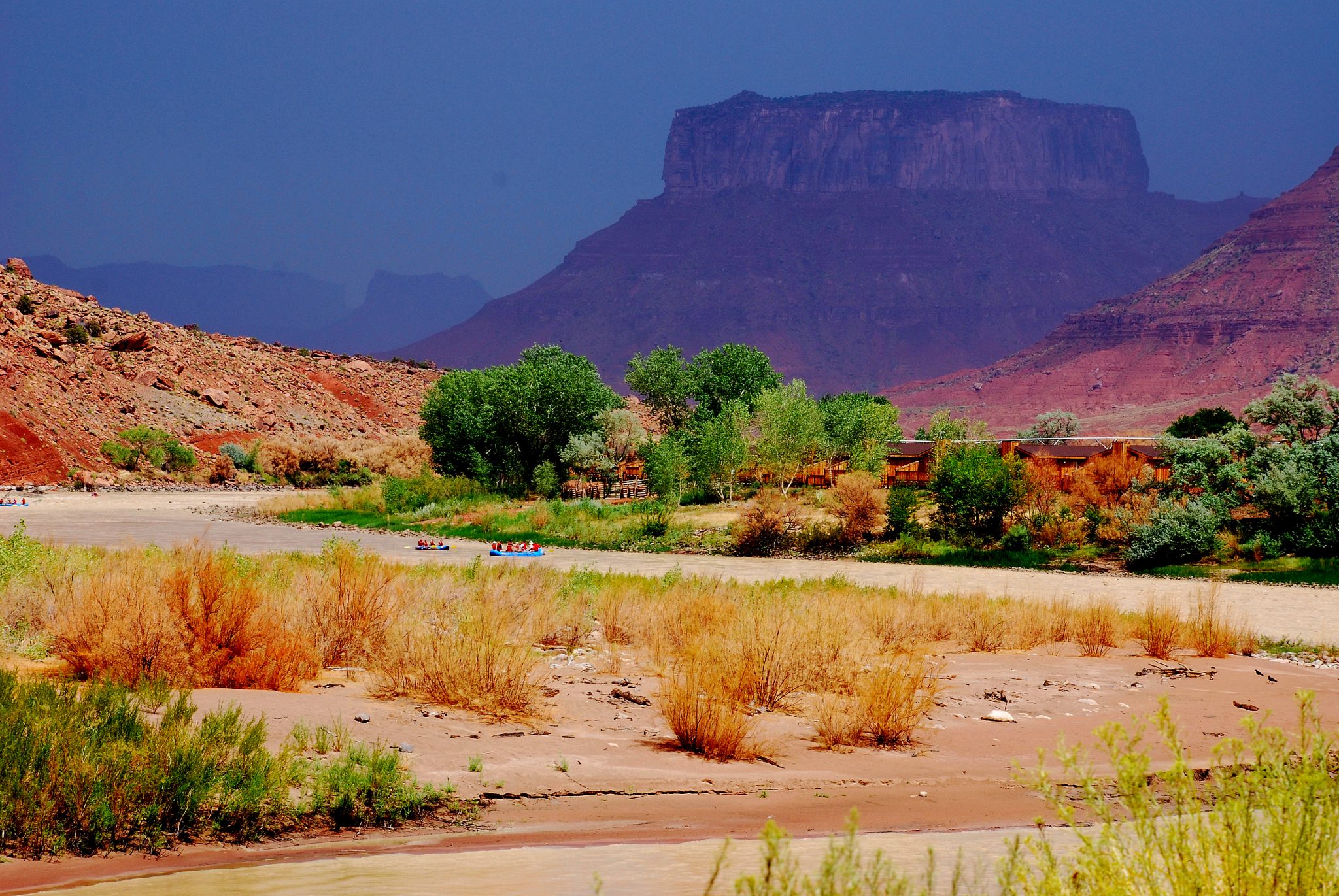
Mile 29.8 SR 128 crosses the river here. On the right are the ruins of the historic Dewey Bridge, which burned in 2008. From here to I-70, the route leaves the river and crosses open desert country. If you’re returning to Moab or planning to drive the Castle Valley side trip, turn around here. Driving southbound, you’ll be treated to an amazing view of Fisher Towers with the La Sals in the background. The featured photo at the top of this post was shot in this section.
Mile 44.5 Junction with I-70, Exit 204.
I hope you’ve enjoyed your 44 miles of WOW on Utah SR 128. Thanks for visiting! Please come back on Sunday, April 23, for another scenic road trip as we visit the Cherohala Skyway in Tennessee and North Carolina.