
This is the summary report of a road trip taken April 10-15. I flew from Los Angeles to El Paso, rented a car, then drove 2,300 miles. I had five primary destinations, each of which will be featured in this blog. They were: Guadalupe Mountains National Park, Palo Duro Canyon, the historic town of Lincoln, NM, the Very Large Array, and White Sands National Monument. White Sands was last week’s feature; the others will appear in future updates. For this trip report, I’ll only discuss the other things I experienced.
If a trip report doesn’t interest you, I won’t be hurt if you skip this week’s post. Well . . . maybe a little. But be sure to check back next Sunday when the blog will take you to the fascinating VLA, located west of Socorro, New Mexico.
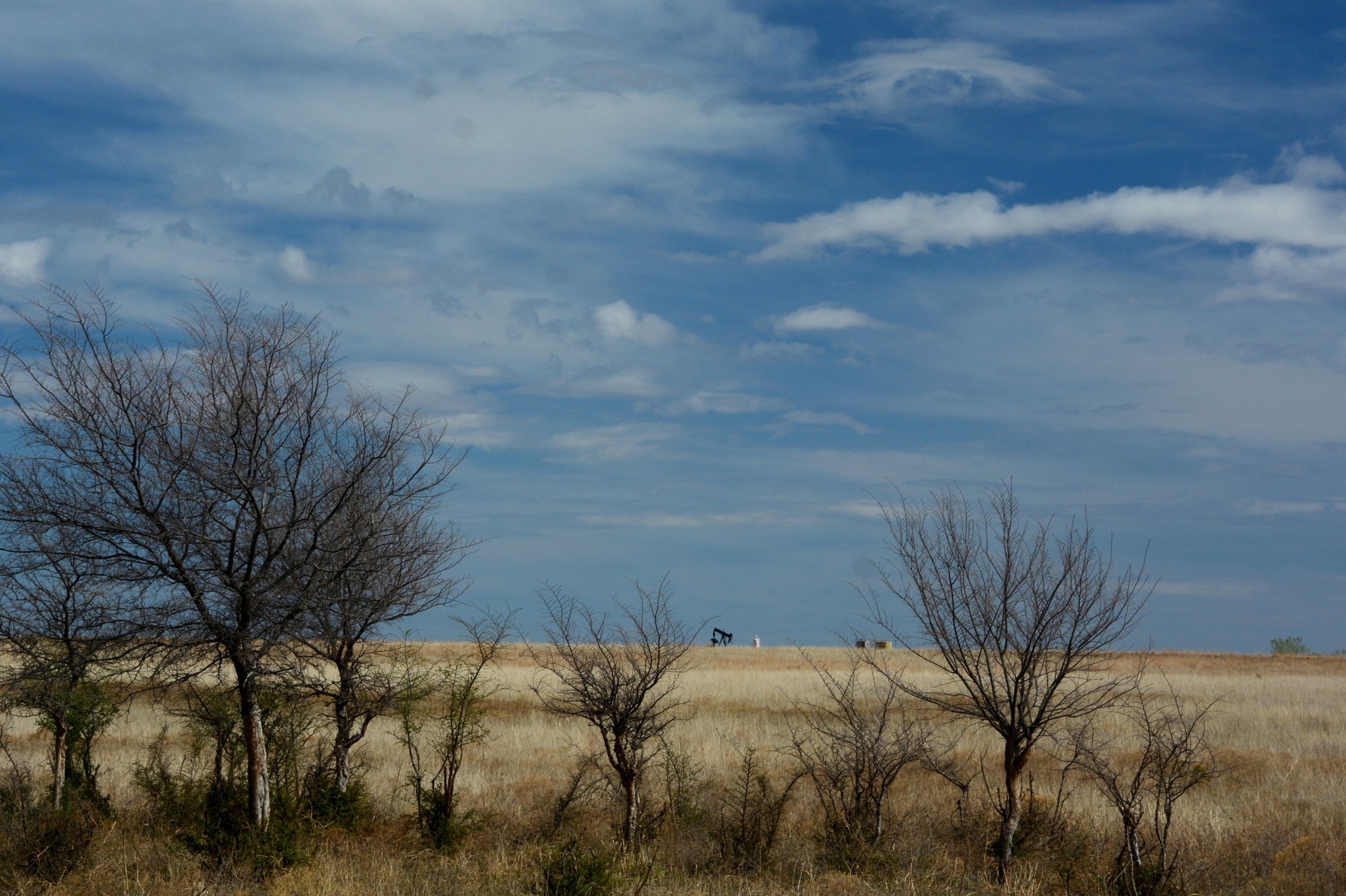
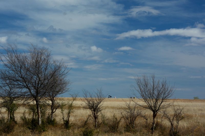
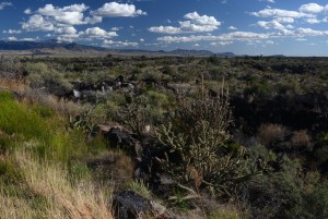
Okay, now that I’m home, I have to admit the drive from New Mexico to Palo Duro Canyon near Amarillo, Texas, involved hundreds of miles traversing some of the butt-ugliest terrain in North America. The radio offered a choice of country music or Baptist preachers, neither of which is my cup of diet soda. Luckily, the speed limits were 65-75 mph. You can see an example of West Texas scenery in the photo above.
Here’s the day-to-day summary:
Sunday, April 10 – home to Carlsbad, NM
Driving to LAX is a breeze on a Sunday. American Airlines Flight 5978 departed on time at 8:50 a.m. and arrived 5 minutes early, at 11:41. The plane was only about half full. The aircraft was a 70-passenger Brazilian-made Embraer 175 – probably the most comfortable regional jet. American’s regional jets use a remote terminal. You check in at Terminal 4, then go to Gate 44, where you board a bus that takes you to the gate area. It’s about a 10-minute ride. There are eight remote gates. At each, you walk up a long ramp to board your aircraft.
My rental vehicle was a base model Nissan Altima, which was an okay car. The base four-cylinder engine and transmission were decent. Handling was so-so. It had a backup camera, which I liked, but the radio was crummy. It had a push-button start, but the remote key triggered the horn whenever I locked the car. I’m sure it annoyed other people nearby as much as it did me. One bonus: The Altima averaged 36.6 mpg for the trip. And gas was cheap everywhere I went.
From El Paso airport, combined US 62/180 lead directly to Carlsbad, New Mexico, my destination for the evening. It may be direct, but it’s long and mostly boring. The only interesting portion was the section in Guadalupe Mountains National Park. The highway also provides access to the entrance road for Carlsbad Caverns National Park. Unfortunately, the park’s elevators are down (literally). I may be able, at my advanced age, to hike the 800 vertical feet down into the cave, but not the climb out.
I stayed at the Super 8 motel, which had three stories and no elevator.
Monday, April 11 – Carlsbad to Amarillo, Texas
Southeastern New Mexico and much of West Texas is oil country that’s singular in its ugliness. Traversing that was half my day, and the other half was through cropland and pasture — not as ugly but just as boring. All of it was absolutely flat; the most interesting scenery was the movement of the clouds. This is the Llano Estacado, a windblown plateau that merges northward with the high plains covering the Oklahoma Panhandle, eastern Colorado, western Kansas and much of southern Nebraska. People who live in this country have to drive 200 miles to reach the nearest hill. And throughout this area, when the wind isn’t howling, it’s simply blowing hard.
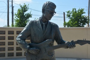
I drove through Lubbock, an agreeable-enough city of 250,000 with two claims to fame. One is the big campus of Texas Tech University, and the other is the shrine to a ‘50s rock-and-roller who grew up here. Buddy Holly died in a plane crash in 1959, well before the vast majority of Lubbock residents were born. Trivia question for you rock fans: What other performers died in that plane crash? See below for the answer.
Since Holly’s death, the best thing to come out of Lubbock is Interstate 27, which carries you at 75 mph 120 miles north to Amarillo. As I sped along, the weather changed from 75 degrees and sunny in Lubbock to 45 and cloudy in Amarillo, As a result, I had crappy light for my detour to Palo Duro Canyon.
I stayed in the same Comfort Inn I used on my last overnight in Amarillo several years ago. I remember that as I left the next morning that day, parked next to me was a van labeled “Official Tornado Chase Vehicle.” Fortunately, there weren’t any tornadoes this time.
For dinner, I had the mandatory Texas meal of barbecued brisket with beans and slaw. Wahoo!
Trivia answer: Richie Valens and the Big Bopper. Really.
Tuesday, April 12 – A loop through western Oklahoma
I’d operated under the assumption I was flying home Thursday. So I found myself with an extra day I decided to use by looping eastward then north through part of Oklahoma, with a stop at the new Washita Battlefield National Historic Site. Compared to the country I’d traversed on Monday, western Oklahoma was downright scenic. The battlefield, however, was disappointing, even if the event it commemorated was interesting. The U.S. cavalry, led by Lt. Col. George Armstrong Custer, defeated an outmanned group of native Americans. Of course, Ol’ George got promoted to general in time for his visit to the Little Big Horn. (I’m planning to visit there in September.)
My destination for the night was the Texas town of Dumas. That’s pronounced DOO-mas and not “dumbass” like I overheard someone saying in the restaurant next door to the Best Western where I stayed.
Wednesday, April 13 – Dumas to Socorro, NM
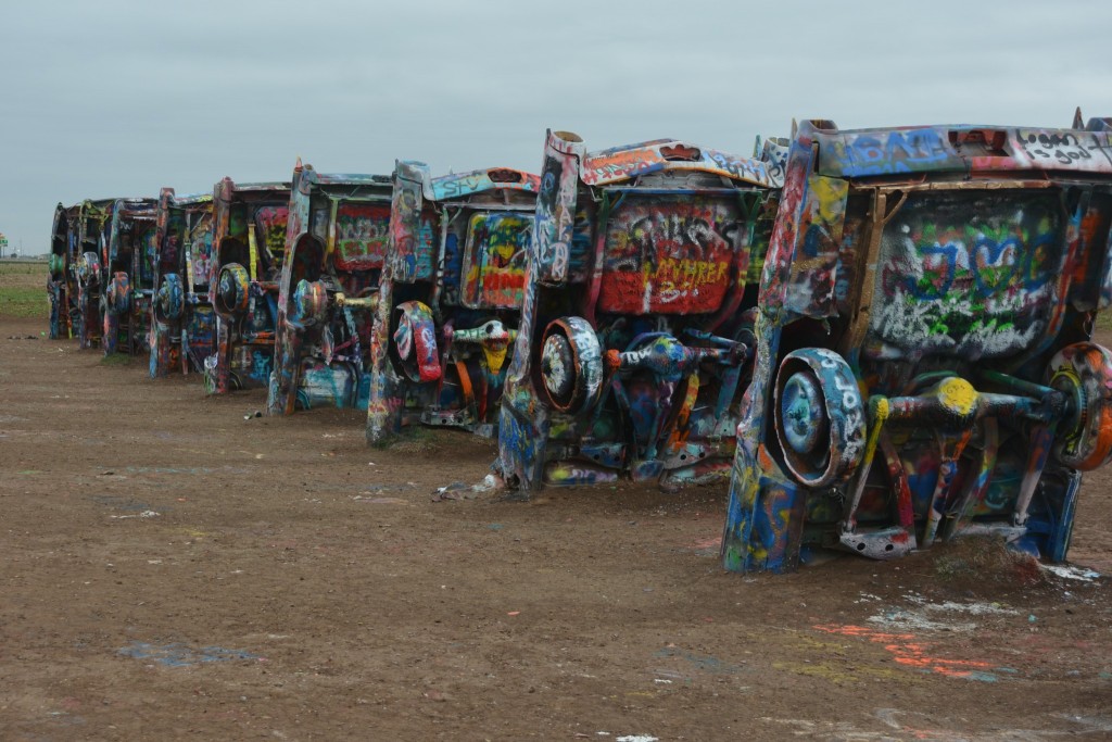
I began the day by visiting the must-see offbeat attraction known as Cadillac Ranch, which is on the western outskirts of Amarillo. There, 10 vintage, big-finned Caddies are planed nose-first at the same jaunty angle into the West Texas dirt. It’s free. There are no hours. You just drive up, walk through a turnstile, then follow a path. The cars are covered in spray-painted graffiti, and you’re welcome to add your own. Cadillac Ranch is popular; it eems there’s always a small crowd there. Keep this on your list next time you’re road-tripping on I-40 across Texas. Take Exit 60, then follow the south frontage road eastward a half mile or so. Continue straight to get back on I-40 eastbound. If you’re heading west, retrace your steps to the onramp. For a huge listing of offbeat attractions along major U.S. highways, check out www.roadsideamerica.com
From Amarillo to Roswell, NM, it’s about 3 hours of driving through ugly country. Once in New Mexico, much of the land appears to be abandoned farms and pastures. I saw dozens of abandoned houses, their windows open to the constant wind. You wonder about the people who once lived out here, battered by the wind and laboring to make a go of it, then having to give up. What stories could they tell!
I thought I might stop at the UFO Museum in Roswell. It turned out to be a downtown storefront with no parking anywhere in sight. So I went to McDonalds instead.
After stopping in the historic town of Lincoln (separate post forthcoming), I continued west through Carrizozo and past the Valley of Fires lava field to San Antonio, home of the famed Owl Bar – famous for its legendary green chile cheeseburgers. I didn’t stop; my taste buds were set for some genuine New Mexican cuisine in Socorro, 10 miles to the north.
I ate at Frank and Lupe’s El Sombrero and had sopapillas stuffed with carne adovada. Wow! This was, by far, the best meal of the trip.
Thursday, April 14 – Socorro to Alamogordo, NM
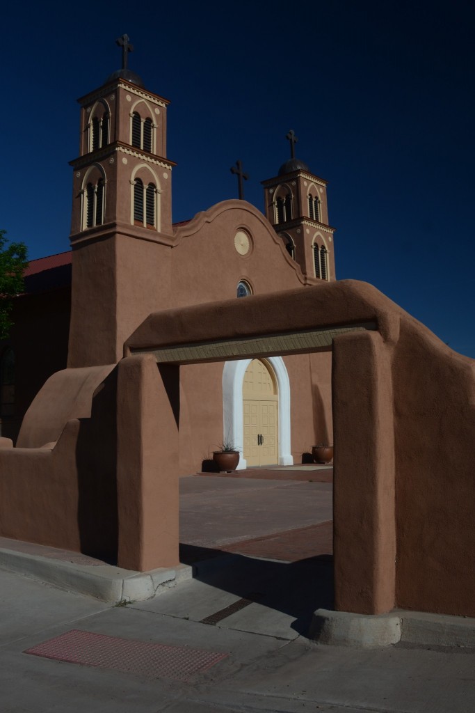
This was the best day of the trip, with nice scenery and perfect weather. Socorro is a very cool small town that was founded by the Spanish in the 1600s. Many of their descendants still live here. It’s about 75 miles south of Albuquerque along I-25. Take the Socorro exit, and you’ll find yourself in a different world. It’s a very traditional place with distinctive New Mexican architecture. Socorro’s heart is its leafy plaza. I started by cruising Socorro’s plaza and visiting the beautiful San Miguel Mission, the oldest Catholic church in the United States. Offsetting Socorro’s Spanish colonial vibe is the high-tech campus of the New Mexico Institute of Mining and Technology. To learn more about Socorro, go to www.socorronm.org
From Socorro, it’s an hour’s drive on US 60 through the old cattle town of Magdalena to the Very Large Array, a deep space tracking system that’s part of the National Radio Astronomy Laboratory. This is an awesome place that will be featured in a separate future blog post.
From the VLA, I headed west through mountain country to US 180, then went south to Silver City and Deming, where I picked up I-10 for the boring, hourlong drive to Las Cruces. From there, US 70 took me across the Organ Mountains and through part of the White Sands Missile Range to White Sands National Monument – see last week’s post for details. The section of US 180 from SR 12 to Silver City is an exceptionally scenic drive.
I stayed in Alamogordo at a Days Inn that was – how shall I put this? – a dump. They offered wi-fi, but there was no desk and no outlets. If you want to use a laptop and need an outlet, you’d have to work standing up in the bathroom. You have to wonder who designs motel rooms.
Friday, April 15 – Alamogordo to El Paso and home
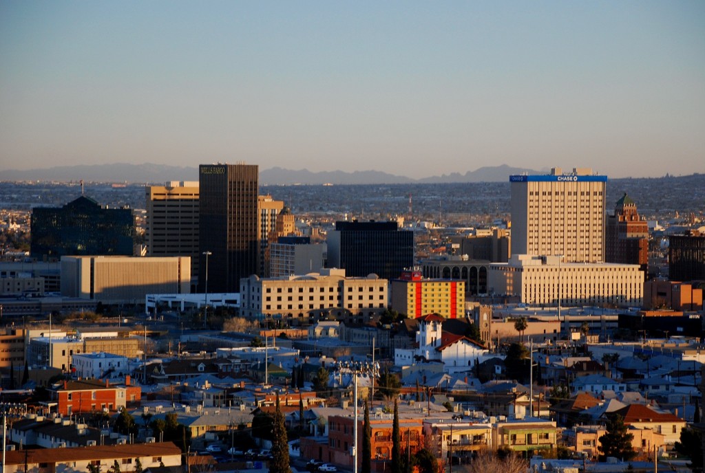
From Alamogordo, it’s a straight shot down US 54 for 85 miles to El Paso. My flight home – same flight number, same aircraft type – took off on time at 12:20 and landed on time at LAX at 1:26. This time, the plane was completely full. Unfortunately, several regional flights arrived at about the same time, and there was a huge line of people wait to board the bus for the main American Airlines terminal. By the time I got my checked bag and rode the shuttle to the parking garage, it was after 3. Hello, Friday afternoon rush hour! It took almost two hours to drive the 23 miles to Whittier from the airport.
That’s my trip report. Next trip: May 10-18 to Juneau and Sitka, Alaska.